Via Ferrata Summits
A via ferrata (Klettersteig in German) protects a climbing route with steel cables, rungs and ladders, so walkers can reach summits that would otherwise need a rope. The first were built in the Eastern Alps in the 19th century; the network spread through the Dolomites with the paths of the First World War front.
These 38 summits have a via ferrata on or near their normal route, most of them in the Eastern Alps, Western Alps and Gran Paradiso massif. Grades run from A (easy, mostly walking) to E (very steep and strenuous). You need a helmet, a harness and a via ferrata set with an energy absorber, and a head for heights.
- Peaks
- 38
- Countries
- 6
The List
- Wildspitze, 3,768 m, Weißkamm · AustriaWeißkamm · AustriaAlpine hike3,768 m
Normal route from Vent via the Breslauer Hütte and Mitterkarjoch · F · I · VF C · 7h 45m up · 2 days · best Jul–Aug · GPX
- Monte Emilius, 3,559 m, Gran Paradiso massif · ItalyGran Paradiso massif · ItalyAlpine hike3,559 m
Via ferrata on the west ridge from Col Carrel over the Piccolo Emilius · VF C · 8h up · 2 days · best Jul–Aug · GPX
- Mount Adamello, 3,539 m, Adamello-Presanella Alps · ItalyAdamello-Presanella Alps · ItalyAlpine hike3,539 m
From Val Genova via Rifugio ai Caduti dell'Adamello and the Pian di Neve · F+ · II · 9h up · 2 days · best Jul–Aug · GPX
- Hochalmspitze, 3,360 m, Ankogel Group · AustriaAnkogel Group · AustriaEasy alpine3,360 m
From the Gießener Hütte via the Detmolder Grat · PD+ · II · VF C · 7h up · 2 days · best Aug · GPX
- Marmolada, 3,343 m, Dolomites · ItalyDolomites · ItalyAlpine hike3,343 m
From Lago di Fedaia via Pian dei Fiacconi and the Marmolada Glacier · F · II · 5h up · best Jul–Aug · GPX
- Tofana di Mezzo, 3,244 m, Tofane · ItalyTofane · ItalyAlpine hike3,244 m
Normal route from Rifugio Dibona via Rifugio Giussani, Forcella Vallon and the Tofana saddle · F · 6h up · best Jul–Aug · GPX
- Tofana di Rozes, 3,225 m, Tofane · ItalyTofane · ItalyAlpine hike3,225 m
Normal route from Rifugio Dibona via Rifugio Giussani · I · T4 · 4h 30m up · best Aug–Sep · GPX
- Monte Civetta, 3,220 m, Northern Dolomites of Zoldo · ItalyNorthern Dolomites of Zoldo · ItalyEasy walk3,220 m
Normal route from Palafavera via Rifugio Coldai, Sentiero Tivan, Passo del Tenente and Rifugio Torrani · II · 8h 45m up · 2 days · best Jul–Aug · GPX
- Kitzsteinhorn, 3,203 m, Glockner Group · AustriaGlockner Group · AustriaAlpine hike3,203 m
From the Gipfelwelt 3000 cable car station via the west ridge · T4 · VF A/B · 30m up · best Jul–Aug · GPX
- Piz Boè, 3,152 m, Sella group · ItalySella group · ItalyMountain hike3,152 m
From Passo Pordoi via the Forcella Pordoi · T3 · 3h 45m up · best Jul–Sep · GPX
- Cima Brenta, 3,151 m, Brenta group · ItalyBrenta group · ItalyEasy alpine3,151 m
North normal route from Rifugio Tuckett via Bocca di Tuckett and the Cengia Garbari · PD · II · 6h 30m up · 2 days · best Jul–Aug · GPX
- Grosser Hafner, 3,076 m, Ankogel Group · AustriaAnkogel Group · AustriaAlpine hike3,076 m
From the Kölnbrein dam via the Kattowitzer Hütte and the SW ridge · T4 · VF A · 5h 30m up · 2 days · best Jul–Sep · GPX
- Piz dles Cunturines, 3,064 m, Fanes Group · ItalyFanes Group · ItalyAlpine hike3,064 m
From Capanna Alpina via Col de Locia, Jù dal'Ega and the Tru Dolomieu · I · T4 · VF A/B · 6h up · best Jul–Sep · GPX
- Sas Rigais, 3,025 m, Odle Group · ItalyOdle Group · ItalyAlpine hike3,025 m
South-west via ferrata from Col Raiser · T4 · VF B · 4h up · best Jul–Sep · GPX
- Kesselkogel, 3,004 m, Dolomites · ItalyDolomites · ItalyMountain hike3,004 m
West via ferrata from Passo Principe , approach from Ciampedie · VF B · 5h 30m up · best Jul–Sep · GPX
- Hoher Dachstein, 2,995 m, Dachstein Mountains · AustriaDachstein Mountains · AustriaAlpine hike2,995 m
From the Hunerkogel via the Schulter and Randkluft via ferratas · F · VF B · 2h 45m up · best Jul–Sep · GPX
- Zugspitze, 2,962 m, Wetterstein · Germany, AustriaWetterstein · Germany, AustriaMountain hike2,962 m
From Garmisch-Partenkirchen through the Partnachklamm and the Reintal · T3 · VF A · 11h 45m up · 2 days · best Jul–Sep · GPX
- Hochkönig, 2,941 m, Hochkönig mountain range · AustriaHochkönig mountain range · AustriaMountain hike2,941 m
Normal route from the Arthurhaus via the Mitterfeldalm, Torsäule and Übergossene Alm · T3 · 6h 45m up · best Jul–Sep · GPX
- Triglav, 2,864 m, Triglav Group · SloveniaTriglav Group · SloveniaAlpine hike2,864 m
From Pokljuka via Vodnikov dom and Dom Planika · T4 · VF B · 8h 15m up · 2 days · best Jul–Sep · GPX
- Große Sandspitze, 2,770 m, Central Lienz Alps · AustriaCentral Lienz Alps · AustriaAlpine hike2,770 m
From the Karlsbader Hütte via the Ari-Schübel-Steig and the west flank · II · VF B/C · 5h 45m up · 2 days · best Jul–Sep · GPX
- Jôf di Montasio, 2,754 m, Catena Jôf Fuârt-Montasio · ItalyCatena Jôf Fuârt-Montasio · ItalyAlpine hike2,754 m
Via Normale by the Scala Pipan from the Montasio plateau · F · I+ · VF B/C · 5h up · best Jul–Sep · GPX
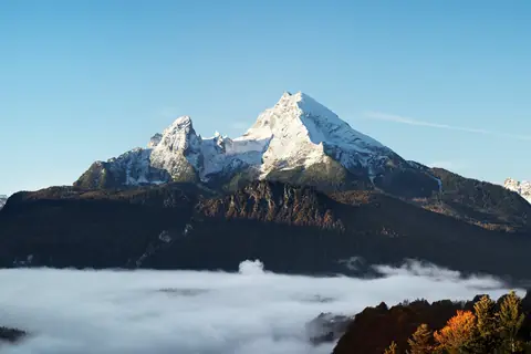
- Watzmann, 2,713 m, Zentralwestliche Berchtesgadner Alpen · GermanyZentralwestliche Berchtesgadner Alpen · GermanyAlpine hike2,713 m
From Wimbachbrücke via Watzmannhaus and Hocheck · F · I · T4 · 8h 15m up · 2 days · best Jul–Sep · GPX
- Peralba, 2,694 m, Western Carnic Alps · ItalyWestern Carnic Alps · ItalyAlpine hike2,694 m
Normal route from the Sorgenti del Piave via Rifugio Calvi and Passo Sesis · I · T4 · 3h 30m up · best Jul–Sep · GPX
- Mangart, 2,678 m, Catena Mangart-Jalovec · Slovenia, ItalyCatena Mangart-Jalovec · Slovenia, ItalyMountain hike2,678 m
Italian route from the Mangart Saddle · T3 · 3h 15m up · best Jul–Sep · GPX
- Birnhorn, 2,634 m, Loferer und Leoganger Steinberge · AustriaLoferer und Leoganger Steinberge · AustriaEasy alpine2,634 m
From Leogang via the Passauer Hütte and the Kuchelnieder · I · T5 · VF B · 8h up · 2 days · best Aug–Sep · GPX
- Razor, 2,601 m, Škrlatica Group · SloveniaŠkrlatica Group · SloveniaAlpine hike2,601 m
From Zadnjica via Pogačnikov dom and Sedlo Planja · T4 · VF C · 9h up · 2 days · best Jul–Sep · GPX
- Kanin, 2,587 m, Western Julian Alps · Italy, SloveniaWestern Julian Alps · Italy, SloveniaAlpine hike2,587 m
Via ferrata Julia from Sella Nevea via Rifugio Gilberti · T5 · VF C · 8h 30m up · best Jul–Sep · GPX
- Grintovec, 2,558 m, Central Kamnik–Savinja Alps · SloveniaCentral Kamnik–Savinja Alps · SloveniaMountain hike2,558 m
From Kamniška Bistrica via Cojzova koča and the Streha · T3 · 6h 30m up · best Jul–Sep · GPX
- Hoher Göll, 2,522 m, Göll · Austria, GermanyGöll · Austria, GermanyAlpine hike2,522 m
Salzburger Steig from the Purtschellerhaus · I · T4 · VF B · 5h 15m up · best Jul–Sep · GPX
- Großer Priel, 2,515 m, Prielgruppe · AustriaPrielgruppe · AustriaAlpine hike2,515 m
From Hinterstoder via the Prielschutzhaus, Kühkar and Brotfallscharte · T4 · VF A/B · 7h 45m up · 2 days · best Jul–Sep · GPX
- Ellmauer Halt, 2,344 m, Kaiser Mountains · AustriaKaiser Mountains · AustriaAlpine hike2,344 m
Gamsängersteig from the Wochenbrunner Alm via the Gruttenhütte · I · T4 · VF B · 5h up · best Jul–Sep · GPX
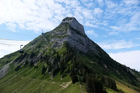
- Tour d'Aï, 2,331 m, Vaud Prealps · SwitzerlandVaud Prealps · SwitzerlandMountain hike2,331 m
From Leysin via the Lac d'Aï · T3 · 4h up · best Jul–Sep · GPX
- Kellenspitze, 2,238 m, Allgäu Alps · AustriaAllgäu Alps · AustriaAlpine hike2,238 m
Normal route from Nesselwängle via the Gimpelhaus, Tannheimer Hütte and Nesselwängler Scharte · II · T4 · 4h 45m up · best Jul–Sep · GPX
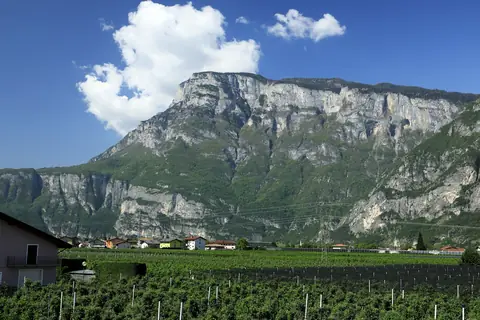
- Paganella, 2,125 m, Brenta group · ItalyBrenta group · ItalyHike2,125 m
From Andalo via Dosson, Doss Pelà and Malga Zambana · T2 · 1h 30m up · best Jul–Sep · GPX
- Peak of Céüse, 2,016 m, massif Céüse-Aujour · Francemassif Céüse-Aujour · FranceHike2,016 m
From the former Céüze 2000 ski station via the Sommet des Marseillais · T2 · 2h 15m up · best Sep–Oct · GPX
- Moléson, 2,002 m, Fribourg Prealps · SwitzerlandFribourg Prealps · SwitzerlandHike2,002 m
From Moléson-sur-Gruyères via Plan-Francey · T2 · 4h up · best Jun–Sep · GPX
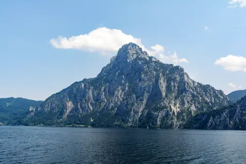
- Traunstein, 1,691 m, Upper Austrian Prealps · AustriaUpper Austrian Prealps · AustriaMountain hike1,691 m
Mairalmsteig from the Umkehrplatz via the Kaisertisch · T3 · VF A/B · 5h 45m up · best Sep–Oct · GPX
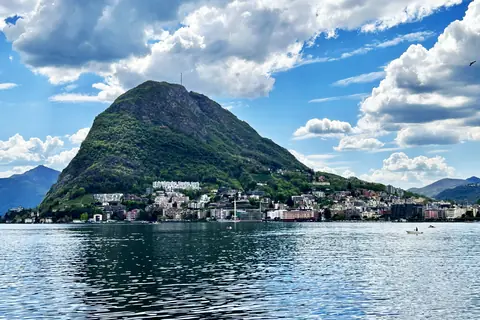
- Monte San Salvatore, 912 m, Catena Gino-Camoghè-Fiorina · SwitzerlandCatena Gino-Camoghè-Fiorina · SwitzerlandHike912 m
From Lugano-Paradiso via Pazzallo · T2 · 2h 30m up · best Apr–May · GPX
Questions
- What equipment do you need for a via ferrata?
- A climbing helmet, a harness and a via ferrata set (two lanyards with carabiners and an energy absorber built to EN 958). Gloves save your hands on the cables. Most valley sports shops rent sets.
- How are via ferratas graded?
- Usually on the A–E scale used in the Alps: A is easy and well protected, B moderate, C difficult and steep, D very difficult and E extremely difficult, mostly vertical or overhanging. Some guidebooks use 1–6 instead.