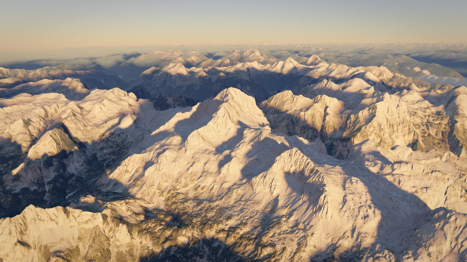
Triglav
2,864 m
Slovenia
Also known as Триглав, Terglau, +5Also known as
Триглав · Terglau · Τρίγκλαβ · Tricorno · ტრიგლავი · Trzygłów · гора Триглав
- Elevation
- 2,864 m
- Prominence
- 2,059 m
- Difficulty
- 4/10
- Alpine hike
- Best Season
- Jul–Sep
- Routes
- 2
Routes
2The highest trailhead and the gentlest approach: a long hut-to-hut walk from Rudno polje (1,340 m) across the Pokljuka plateau to Dom Planika (2,401 m), then a short, fully protected scramble with pegs and cables via Mali Triglav to the summit. Usually done over two days.
Elevation Profile
- Distance
- 12.8 km
- one way
- Ascent
- +1,833 m
- −311 m lost on the way up
- High Point
- 2,864 m
- Time Up
- 8h 20m
- DIN 33466
- Time Down
- 6h 19m
- DIN 33466 · same way back
From the car park at Rudno polje on the Pokljuka plateau the marked path climbs through forest to the Studor pass (Studorski preval, 1,892 m) in about 2 hours, then contours a balcony path around Tosc to Vodnikov dom on Velo polje (1,817 m), about 3 hours in all. From Vodnikov dom the path heads north to the Konjsko sedlo (about 2,020 m) and climbs the last step to Dom Planika (2,401 m) in roughly 1¾–2 hours. Most people sleep at Planika or Vodnikov dom. From Dom Planika the summit takes about 1¾ hours. The path drops slightly, crosses scree and enters a gully with iron pegs and cables, then climbs secured rock to the ridge just below Mali Triglav, where the route from Kredarica joins. The ridge between Mali Triglav (about 2,725 m) and the main summit is narrow and exposed but continuously cabled; it then widens to the summit and the Aljaž Tower. This is roughly the line of the first ascent in 1778. Descend the same way, or traverse to Kredarica and down to the Krma or Vrata valleys. On fine summer weekends queues form on the cables; start early, and turn back if thunderstorms build, as the cables and tower attract lightning. Slovenian guidance calls for a helmet, harness and self-belay (via ferrata) set on all summit routes.
Start
Rudno polje1,342 m
- Bus to Bohinj or Bled; seasonal summer buses to the Pokljuka plateau and Rudno polje have run in recent years but the current timetable must be checked locally.
- Parking at the trailhead
Stages
| Day | Stage | km | m ascent | m descent | Time |
|---|---|---|---|---|---|
| 1 | Rudno polje → Dom Planika pod Triglavom | 11.3 | 1,349 | 291 | 6h 29m |
| 2 | Dom Planika pod Triglavom → Triglav | 1.5 | 484 | 21 | 1h 50m |
Waypoints
- Parking: Rudno polje1,342 m
- Col: Studorski preval1,890 m
- Hut: Vodnikov dom na Velem polju1,820 m
- Col: Konjsko sedlo2,021 m
- Hut: Dom Planika pod Triglavom2,402 m
- Shoulder: Mali Triglav2,737 m
- Summit: Triglav2,864 m
Key Passages
- Studorski preval
- Konjsko sedlo
- Secured gully above Dom Planika (pegs and cables)
- Exposed cabled ridge between Mali Triglav and Triglav
Equipment
0/9 packedDownloads
Route confidence 80%Overview
Slovenia's highest peak (2,864 m) and national symbol, at the heart of the Julian Alps and Triglav National Park. Every route ends with a short, exposed but continuously cabled limestone ridge, reached after a long hut-to-hut approach.
Triglav rises from a high karst plateau in the eastern Julian Alps, between the Vrata, Krma and Kot valleys to the north and the Pokljuka plateau and Bohinj to the south. Its north face, more than 1,000 m high and several kilometres wide, is one of the largest walls in the Eastern Alps. The summit carries the Aljaž Tower, a small metal shelter put up in 1895, and the mountain's outline appears on Slovenia's coat of arms and flag.
There is no easy walk to the top. All marked routes finish on 'very difficult' secured paths with iron pegs and cables, most commonly over Mali Triglav and the narrow ridge beyond it. The difficulties are short (1–2 hours from the highest huts) but exposed, polished by traffic and crowded on summer weekends. Getting to those huts is the bulk of the effort: 1,100–1,900 m of ascent depending on the valley.
For a fit walker comfortable with exposure, Triglav is a good first via ferrata summit, usually done over two days. For many Slovenians it is a rite of passage, and first-timers are traditionally 'birched' on the summit. The small Triglav Glacier below the north-east side has shrunk to a few remnants and was no longer classed as a glacier from 2019.
Climbing Notes
Good fitness for 6–8 hour days with up to 1,900 m of ascent, sure-footedness and a head for heights are the main requirements; no glacier or rope skills are needed in summer. Altitude is not a significant issue. A helmet is strongly advised on all routes, and Slovenian tourism and alpine club guidance recommends a harness and via ferrata set for the secured sections. Those new to via ferrata can hire an IFMGA guide in Bohinj, Bled or Mojstrana.
Typical itineraries: from Pokljuka (Rudno polje), walk to Dom Planika or Vodnikov dom on day one and summit early on day two; from the Vrata valley, climb the Prag route to Kredarica, summit the same afternoon or next morning and descend by the Tominšek or Prag route. The Krma valley approach to Kredarica is the easiest from the north but the longest. Book huts well ahead for July–September weekends; sleeping bags are not allowed in the huts, so bring a liner.
Start early: afternoon thunderstorms are common in summer, and the summit cables and tower are a lightning hazard. Snow can linger in gullies and on the ridge into early July and returns from October, when crampons and an ice axe are needed. Check path conditions on stanje-poti.pzs.si, as sections occasionally close for maintenance.
History
The first recorded ascent was on 26 August 1778 by four men from Bohinj, the surgeon Lovrenc Willomitzer, the chamois hunter Štefan Rožič and the miners Luka Korošec and Matevž Kos, at the initiative of Baron Sigmund Zois, approximately along today's route from Dom Planika. In 1895 the priest Jakob Aljaž bought the summit for one florin and erected the Aljaž Tower, assembled on 7 August 1895. The first hut on Kredarica was built in 1896, also at Aljaž's initiative, and enlarged in 1909 as Triglavski dom; weather observations began there in 1897 and it remains Slovenia's highest hut and meteorological station. The mountain gave its name to Triglav National Park, Slovenia's only national park.
Season
Best Jul–Sep- January: Not advisable
- February: Not advisable
- March: Not advisable
- April: Not advisable
- May: Not advisable
- June: Possible
- July: Best (best window)
- August: Best (best window)
- September: Best (best window)
- October: Possible
- November: Not advisable
- December: Not advisable
- Jan
- Winter mountaineering only; huts closed (meteorologists at Kredarica offer basic emergency shelter)
- Feb
- Winter conditions; avalanche risk on approaches
- Mar
- Ski-touring to Kredarica from Krma for experienced parties
- Apr
- Spring snow; avalanche risk
- May
- Snow on the upper routes; most huts closed
- Jun
- Huts open in June (Kredarica from 6 June in 2026); snow in gullies and on the ridge
- Jul
- Main season; crowded at weekends; afternoon thunderstorms
- Aug
- Main season; very busy around Slovenian holidays
- Sep
- Often stable weather and fewer people
- Oct
- Huts close (Kredarica until 4 October in 2026); early snow and ice on cables
- Nov
- Winter conditions
- Dec
- Winter conditions
Access & Permits
- Hut Booking
- Reservations are mandatory at Triglavski dom na Kredarici (online at triglavskidom.si; free cancellation up to 2 days before). For Dom Planika and Vodnikov dom, book directly with the huts; summer weekends fill early.
- Fees
- Parking at Rudno polje (Pokljuka) is paid
- Summer parking in the upper Vrata valley costs up to EUR 50 per day (15 June – 15 September 2026); the bus from Mojstrana is free, with optional seat reservation at EUR 3
- Hut overnight fees with discounts for alpine club members
- Rules
- Triglav National Park: camping only in designated campsites, no bivouacking or wild camping
- Triglav National Park: drones only with a permit; dogs must be kept on a lead; no swimming in the alpine lakes; stay on marked paths
- Sleeping bags are not allowed in Slovenian huts; use a liner or buy disposable bedding
- Paths are occasionally closed for maintenance; check stanje-poti.pzs.si
- Getting There
Bohinj and Bled (Pokljuka approach); Mojstrana (Vrata and Krma valleys)
Ljubljana Jože Pučnik Airport (LJU)
- Pokljuka: drive from Bled or Bohinj to the car park at Rudno polje; seasonal summer buses to Pokljuka have run in recent years
- Vrata valley: park at Na Prodih (P+R) in Mojstrana and take the free bus to Aljažev dom (15 June – 30 September 2026, first departure 04:00)
- Krma valley: road from Mojstrana to the head of the valley
- Buses run from Ljubljana to Bled, Bohinj and Kranjska Gora/Mojstrana
Hazards
- Exposure
- Weather
- Rockfall
Huts & Shelters
4- 1,015 m
Aljažev dom v VratihHut
- 1,817 m
Vodnikov dom na Velem poljuHut
Summer
- 2,401 m
Dom Planika pod TriglavomHut
Summer
- 2,515 m
Triglavski dom na KredariciHut
304 beds · Staffed early June to early October (6 June – 4 October 2026); outside the season meteorologists provide unheated emergency rooms without meals