The Alpine 4000ers
In 1994 the UIAA published the official list of the Alps' 4000-metre summits: 82 peaks, chosen for their prominence, form and mountaineering importance rather than height alone. Climbing them all is one of the great projects of European mountaineering. Ueli Steck did it in 62 days in 2015; most people take a lifetime.
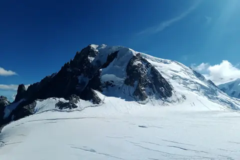
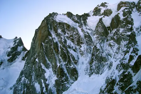
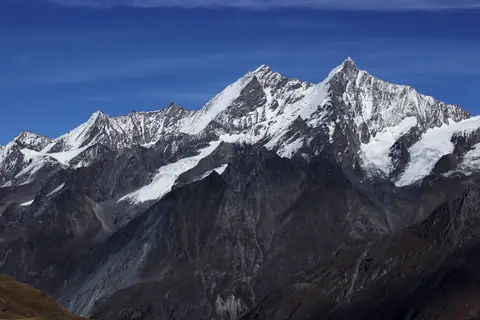
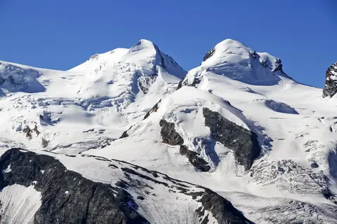
peaks.fyi covers 80 of the 82, from Mont Blanc (4,806 m) down to Les Droites (4,000 m). 46 stand in Switzerland, 36 in Italy and 25 in France, many of them on a border. The easiest — Breithorn, Roccia Nera and Punta Giordani — are glacier ascents graded F or PD; the hardest, like Grand Pilier d'Angle (D), need confident climbing on rock and ice.
Each row gives the normal route, its grade, the ascent time from the start of the route and the months when conditions are usually best.
- Peaks
- 80
- Countries
- 3
The List
- Mont Blanc, 4,806 m, Mont Blanc massif · France, ItalyMont Blanc massif · France, ItalyEasy alpine4,806 m
Goûter Route via the Bosses Ridge · PD- · 9h 30m up · 2 days · best Jul · GPX
- Mont Blanc de Courmayeur, 4,748 m, Mont Blanc massif · France, ItalyMont Blanc massif · France, ItalyEasy alpine4,748 m
Goûter Route to Mont Blanc, then the ridge over the Col Major · PD- · 9h 45m up · 2 days · best Jul · GPX
- Dufourspitze, 4,634 m, Monte Rosa Massif · Italy, SwitzerlandMonte Rosa Massif · Italy, SwitzerlandAlpine climb4,634 m
West Ridge from the Monte Rosa Hut · AD- · III · 10h up · 2 days · best Jul · GPX
- Nordend, 4,608 m, Monte Rosa Massif · Switzerland, ItalyMonte Rosa Massif · Switzerland, ItalyEasy alpine4,608 m
From the Monte Rosa Hut via the Silbersattel · PD+ · II · 10h up · 2 days · best Apr · GPX
- Zumsteinspitze, 4,563 m, Monte Rosa Massif · Italy, SwitzerlandMonte Rosa Massif · Italy, SwitzerlandEasy alpine4,563 m
From the Gnifetti hut via the Colle Gnifetti and the SE ridge · PD · 6h up · 2 days · best Jul–Aug · GPX
- Signalkuppe, 4,554 m, Monte Rosa Massif · Italy, SwitzerlandMonte Rosa Massif · Italy, SwitzerlandAlpine hike4,554 m
From the Gnifetti hut via the Lys glacier and the Colle Gnifetti · F · 5h 30m up · 2 days · best Jul–Aug · GPX
- Dom, 4,546 m, Mischabel group · SwitzerlandMischabel group · SwitzerlandEasy alpine4,546 m
North Flank from the Domhütte · PD+ · 12h up · 2 days · best Jul · GPX
- Lyskamm, 4,527 m, Pennine Alps · Switzerland, ItalyPennine Alps · Switzerland, ItalyAlpine climb4,527 m
East Ridge from the Lisjoch · AD · II · 5h 30m up · 2 days · best Jul · GPX
- Weisshorn, 4,505 m, Weisshorn Mountains · SwitzerlandWeisshorn Mountains · SwitzerlandAlpine climb4,505 m
East Ridge from the Weisshornhütte · AD · III · 11h 45m up · 2 days · best Jul–Aug · GPX
- Täschhorn, 4,491 m, Mischabel group · SwitzerlandMischabel group · SwitzerlandAlpine climb4,491 m
Mischabelgrat from the Mischabeljoch · AD · III · 8h 45m up · 2 days · best Jul · GPX
- Western Lyskamm, 4,479 m, Pennine Alps · Switzerland, ItalyPennine Alps · Switzerland, ItalyEasy alpine4,479 m
SW ridge from the Rifugio Quintino Sella via the Felikjoch · PD+ · II · 7h 30m up · 2 days · best Jul · GPX
- Matterhorn, 4,478 m, Pennine Alps · Switzerland, ItalyPennine Alps · Switzerland, ItalyAlpine climb4,478 m
Hörnli Ridge · AD · III · 7h 15m up · 2 days · best Jul–Aug · GPX
- Picco Luigi Amedeo, 4,469 m, Mont Blanc massif · ItalyMont Blanc massif · ItalyAlpine climb4,469 m
Brouillard Ridge from the Eccles bivouac via the Col Émile Rey · AD+ · III · 12h up · 3 days · best Jul · GPX
- Mont Maudit, 4,465 m, Mont Blanc massif · France, ItalyMont Blanc massif · France, ItalyEasy alpine4,465 m
North face via the Col du Mont Maudit · PD+ · 6h 15m up · 2 days · best Jul · GPX
- Parrotspitze, 4,434 m, Monte Rosa Massif · Italy, SwitzerlandMonte Rosa Massif · Italy, SwitzerlandEasy alpine4,434 m
NE ridge from the Seserjoch · PD- · 4h 45m up · 2 days · best Jul–Aug · GPX
- Dent Blanche, 4,357 m, Pennine Alps · SwitzerlandPennine Alps · SwitzerlandAlpine climb4,357 m
South ridge from the Cabane de la Dent Blanche · AD · III · 10h 15m up · 2 days · best Jul–Aug · GPX
- Ludwigshöhe, 4,341 m, Monte Rosa Massif · Italy, SwitzerlandMonte Rosa Massif · Italy, SwitzerlandAlpine hike4,341 m
From the Gnifetti hut via the Lys Glacier and the Zurbriggenjoch · F · 4h 30m up · 2 days · best Jul–Aug · GPX
- Nadelhorn, 4,327 m, Mischabel group · SwitzerlandMischabel group · SwitzerlandEasy alpine4,327 m
NE Ridge from the Mischabelhütte · PD · II · 8h up · 2 days · best Jul–Aug · GPX
- Schwarzhorn, 4,321 m, Monte Rosa Massif · ItalyMonte Rosa Massif · ItalyEasy alpine4,321 m
North flank from the Zurbriggenjoch · PD+ · 4h 15m up · 2 days · best Jul · GPX
- Grand Combin, 4,309 m, Pennine Alps · SwitzerlandPennine Alps · SwitzerlandEasy alpine4,309 m
NW flank, Voie du Gardien, from the Panossière hut · PD · 11h 45m up · 2 days · best Apr–May · GPX
- Dôme du Goûter, 4,304 m, Mont Blanc massif · France, ItalyMont Blanc massif · France, ItalyEasy alpine4,304 m
Via the Aiguille du Goûter · PD · 7h 15m up · 2 days · best Jul · GPX
- Lenzspitze, 4,293 m, Mischabel group · SwitzerlandMischabel group · SwitzerlandAlpine climb4,293 m
South ridge from the Domhütte via the Lenzjoch · AD- · 11h 30m up · 2 days · best Jul–Aug · GPX
- Finsteraarhorn, 4,274 m, Bernese Alps · SwitzerlandBernese Alps · SwitzerlandEasy alpine4,274 m
SW flank and NW ridge via the Hugisattel · PD · 11h 15m up · 2 days · best Apr–May · GPX
- Mont Blanc du Tacul, 4,248 m, Mont Blanc massif · FranceMont Blanc massif · FranceEasy alpine4,248 m
North-west flank from the Aiguille du Midi · PD · 4h 30m up · 2 days · best Jun–Jul · GPX
- Grand Pilier d'Angle, 4,243 m, Mont Blanc massif · ItalyMont Blanc massif · ItalyHard alpine4,243 m
From the Eccles bivouac via the Col Eccles and Col de Peuterey · D · 11h 15m up · 2 days · best Jul · GPX
- Stecknadelhorn, 4,240 m, Mischabel group · SwitzerlandMischabel group · SwitzerlandAlpine climb4,240 m
From the Mischabelhütte via the Windjoch and the Nadelhorn NE ridge · AD- · 8h 15m up · 2 days · best Jul–Aug · GPX
- Castor, 4,225 m, Pennine Alps · Switzerland, ItalyPennine Alps · Switzerland, ItalyEasy alpine4,225 m
SE ridge from the Rifugio Quintino Sella via the Colle del Felik · PD- · 6h 15m up · 2 days · best Jul–Aug · GPX
- Zinalrothorn, 4,221 m, Pennine Alps · SwitzerlandPennine Alps · SwitzerlandAlpine climb4,221 m
North ridge from the Cabane du Mountet · AD · III · 11h up · 2 days · best Jul–Aug · GPX
- Hohberghorn, 4,218 m, Mischabel group · SwitzerlandMischabel group · SwitzerlandAlpine climb4,218 m
From the Mischabelhütte via the Windjoch, Nadelhorn ridge and Stecknadelhorn · AD · 8h 45m up · 2 days · best Jul–Aug · GPX
- Vincent Pyramid, 4,215 m, Monte Rosa Massif · ItalyMonte Rosa Massif · ItalyAlpine hike4,215 m
North-west slope from Punta Indren via the Gnifetti or Mantova hut · F · 4h up · 2 days · best Jun–Aug · GPX
- Grandes Jorasses, 4,208 m, Mont Blanc massif · Italy, FranceMont Blanc massif · Italy, FranceAlpine climb4,208 m
Normal route from Planpincieux via the Boccalatte hut, Rocher du Reposoir and Rochers Whymper · AD · IV · 9h 45m up · 2 days · best Jul · GPX
- Alphubel, 4,206 m, Mischabel group · SwitzerlandMischabel group · SwitzerlandEasy alpine4,206 m
East flank from Längfluh · PD · 5h up · best Apr · GPX
- Rimpfischhorn, 4,199 m, Pennine Alps · SwitzerlandPennine Alps · SwitzerlandEasy alpine4,199 m
From the Britannia Hut via the Allalinpass and Rimpfischsattel · PD · II · 13h 30m up · 2 days · best Jul–Aug · GPX
- Aletschhorn, 4,194 m, Aletschhorn-Bietschhorn Group · SwitzerlandAletschhorn-Bietschhorn Group · SwitzerlandEasy alpine4,194 m
South-west rib from the Oberaletsch Hut · AD- · II · 12h 30m up · 2 days · best Jul–Aug · GPX
- Strahlhorn, 4,190 m, Pennine Alps · SwitzerlandPennine Alps · SwitzerlandEasy alpine4,190 m
From the Britannia Hut via the Adlerpass and WNW ridge · PD · I · 12h 45m up · 2 days · best Apr–Jul · GPX
- Combin de Valsorey, 4,184 m, Pennine Alps · SwitzerlandPennine Alps · SwitzerlandAlpine climb4,184 m
Arête du Meitin from the Cabane de Valsorey · AD+ · III+ · 10h up · 2 days · best Jul–Aug · GPX
- Punta Whymper, 4,184 m, Mont Blanc massif · Italy, FranceMont Blanc massif · Italy, FranceAlpine climb4,184 m
Grandes Jorasses normal route via the Rocher du Reposoir and Rochers Whymper · AD · III+ · 10h up · 2 days · best Jul · GPX
- Dent d'Hérens, 4,173 m, Pennine Alps · Italy, SwitzerlandPennine Alps · Italy, SwitzerlandAlpine climb4,173 m
Tiefmatten ridge from the Rifugio Aosta · AD · III · 10h up · 2 days · best Jul · GPX
- Breithorn, 4,160 m, Pennine Alps · Switzerland, ItalyPennine Alps · Switzerland, ItalyAlpine hike4,160 m
South flank and west ridge from the Klein Matterhorn · F · 2h 15m up · best Jun–Sep · GPX
- Jungfrau, 4,158 m, Jungfrau-Fiescherhorn Group · SwitzerlandJungfrau-Fiescherhorn Group · SwitzerlandAlpine climb4,158 m
From the Jungfraujoch via the Rottalsattel and south-east ridge · AD- · 3h 15m up · best Apr–Jun · GPX
- Bishorn, 4,149 m, Pennine Alps · SwitzerlandPennine Alps · SwitzerlandAlpine hike4,149 m
North-west flank from the Cabane de Tracuit · F · I · 10h up · 2 days · best Jul–Aug · GPX
- Combin de la Tsessette, 4,135 m, Pennine Alps · SwitzerlandPennine Alps · SwitzerlandEasy alpine4,135 m
Le Corridor from the Cabane FXB Panossière · PD · 11h 15m up · 2 days · best May · GPX
- Aiguille Verte, 4,122 m, Mont Blanc massif · FranceMont Blanc massif · FranceAlpine climb4,122 m
Whymper Couloir · AD · 10h 30m up · 2 days · best Jun · GPX
- L'Isolée, 4,114 m, Mont Blanc massif · FranceMont Blanc massif · FranceHard alpine4,114 m
Traverse of the Aiguilles du Diable from the Col du Diable · D+ · V+ · 6h up · 2 days · best Jul–Aug · GPX
- Aiguille Blanche de Peuterey, 4,112 m, Mont Blanc massif · ItalyMont Blanc massif · ItalyAlpine climb4,112 m
From the Eccles bivouac via the Col de Peuterey · AD+ · IV+ · 11h 45m up · 3 days · best Jun–Jul · GPX
- Mönch, 4,110 m, Jungfrau-Fiescherhorn Group · SwitzerlandJungfrau-Fiescherhorn Group · SwitzerlandAlpine climb4,110 m
South-east ridge · AD- · II · 3h 45m up · 2 days · best Jul–Aug · GPX
- Punta Croz, 4,110 m, Mont Blanc massif · Italy, FranceMont Blanc massif · Italy, FranceAlpine climb4,110 m
Grandes Jorasses normal route to Pointe Whymper, then the summit ridge west to Pointe Croz · AD · III · 9h 45m up · 2 days · best Jul · GPX
- Pointe Carmen, 4,109 m, Mont Blanc massif · FranceMont Blanc massif · FranceHard alpine4,109 m
Traverse of the Aiguilles du Diable from the Col du Diable · D+ · V · 5h 45m up · 2 days · best Jul–Aug · GPX
- Breithornzwillinge, 4,106 m, Pennine Alps · SwitzerlandPennine Alps · SwitzerlandEasy alpine4,106 m
From Klein Matterhorn via the Rossi-Volante bivouac and the Roccia Nera ridge · PD+ · 3h up · best Jul · GPX
- Barre des Écrins, 4,102 m, chaine Écrins-Grande Ruine-Agneaux · Francechaine Écrins-Grande Ruine-Agneaux · FranceEasy alpine4,102 m
Normal route via the Glacier Blanc, north face and west ridge · PD · III · 12h up · 2 days · best Jun–Jul · GPX
- Grande Rocheuse, 4,102 m, Mont Blanc massif · FranceMont Blanc massif · FranceAlpine climb4,102 m
Couloir Whymper from the Couvercle hut · AD+ · 10h 15m up · 2 days · best May–Jun · GPX
- Pointe Médiane, 4,097 m, Mont Blanc massif · FranceMont Blanc massif · FranceHard alpine4,097 m
Arête du Diable from the Col du Diable · D+ · V · 5h 30m up · 2 days · best Jul–Aug · GPX
- Pollux, 4,089 m, Pennine Alps · Switzerland, ItalyPennine Alps · Switzerland, ItalyEasy alpine4,089 m
South-west ridge from Klein Matterhorn · PD+ · III · 3h up · best Jul · GPX
- Schreckhorn, 4,078 m, Schreckhorn-Wetterhorn Group · SwitzerlandSchreckhorn-Wetterhorn Group · SwitzerlandAlpine climb4,078 m
South-west ridge from the Schreckhornhütte · AD+ · IV- · 11h 15m up · 2 days · best Jul–Aug · GPX
- Roccia Nera, 4,075 m, Pennine Alps · Switzerland, ItalyPennine Alps · Switzerland, ItalyAlpine hike4,075 m
South-west flank from Klein Matterhorn · F+ · 2h 30m up · best Jun–Jul · GPX
- Pointe Chaubert, 4,074 m, Mont Blanc massif · FranceMont Blanc massif · FranceHard alpine4,074 m
Arête du Diable from the Col du Diable · D+ · IV+ · 5h 30m up · 2 days · best Jul–Aug · GPX
- Mont Brouillard, 4,069 m, Mont Blanc massif · ItalyMont Blanc massif · ItalyEasy alpine4,069 m
From the Eccles bivouac via the Col Émile Rey · PD+ · 10h 45m up · 2 days · best Jul · GPX
- Punta Margherita, 4,066 m, Mont Blanc massif · Italy, FranceMont Blanc massif · Italy, FranceAlpine climb4,066 m
Grandes Jorasses normal route to Pointe Whymper, then the summit ridge west to Pointe Marguerite · AD · IV · 10h up · 2 days · best Jul–Aug · GPX
- Corne du Diable, 4,064 m, Mont Blanc massif · FranceMont Blanc massif · FranceAlpine climb4,064 m
Col du Diable south-west couloir and north-west ridge · AD · III+ · 5h 30m up · 2 days · best Jul · GPX
- Ober Gabelhorn, 4,063 m, Pennine Alps · SwitzerlandPennine Alps · SwitzerlandAlpine climb4,063 m
East-north-east ridge via the Wellenkuppe · AD · III+ · 10h 15m up · 2 days · best Jul–Aug · GPX
- Gran Paradiso, 4,061 m, Gran Paradiso massif · ItalyGran Paradiso massif · ItalyAlpine hike4,061 m
Normal route from the Rifugio Vittorio Emanuele II · F+ · II · 8h 15m up · 2 days · best Jun–Jul · GPX
- Aiguille de Bionnassay, 4,052 m, Mont Blanc massif · France, ItalyMont Blanc massif · France, ItalyAlpine climb4,052 m
South ridge from the Refuge Durier · AD · II · 11h 45m up · 2 days · best Jun–Jul · GPX
- Gross Fiescherhorn, 4,049 m, Jungfrau-Fiescherhorn Group · SwitzerlandJungfrau-Fiescherhorn Group · SwitzerlandEasy alpine4,049 m
North-west ridge from the Mönchsjochhütte · AD- · II · 7h 15m up · 2 days · best Jul–Aug · GPX
- Piz Bernina, 4,048 m, Bernina Range · SwitzerlandBernina Range · SwitzerlandEasy alpine4,048 m
Spallagrat from the Rifugio Marco e Rosa, approached from Diavolezza via the Fortezza · PD+ · III · 7h 30m up · 2 days · best Jul–Aug · GPX
- Punta Giordani, 4,046 m, Monte Rosa Massif · ItalyMonte Rosa Massif · ItalyAlpine hike4,046 m
From Punta Indren via the Indren Glacier · F · 3h 30m up · best Jun–Jul · GPX
- Punta Elena, 4,045 m, Mont Blanc massif · Italy, FranceMont Blanc massif · Italy, FranceAlpine climb4,045 m
Grandes Jorasses normal route to Pointe Whymper, then the summit ridge west over Pointe Croz · AD · IV · 10h 45m up · 2 days · best Jul · GPX
- Grünhorn, 4,043 m, Jungfrau-Fiescherhorn Group · SwitzerlandJungfrau-Fiescherhorn Group · SwitzerlandEasy alpine4,043 m
From the Konkordiahütte over the Grünegghorn and the SW ridge · PD+ · II · 11h 15m up · 2 days · best Jul–Aug · GPX
- Lauteraarhorn, 4,042 m, Schreckhorn-Wetterhorn Group · SwitzerlandSchreckhorn-Wetterhorn Group · SwitzerlandAlpine climb4,042 m
From the Aarbiwak via the south-face couloir and SE ridge · AD · II · 11h 30m up · 2 days · best Jul · GPX
- Aiguille du Jardin, 4,035 m, Mont Blanc massif · FranceMont Blanc massif · FranceAlpine climb4,035 m
Couloir Whymper, Grande Rocheuse and the W ridge via the Col Armand Charlet · AD+ · III · 10h 45m up · 2 days · best Jun · GPX
- Dürrenhorn, 4,035 m, Mischabel group · SwitzerlandMischabel group · SwitzerlandAlpine climb4,035 m
From the Bordierhütte via the Galenjoch and the N ridge · AD- · III+ · 12h 15m up · 2 days · best Jul–Aug · GPX
- Allalinhorn, 4,027 m, Pennine Alps · SwitzerlandPennine Alps · SwitzerlandEasy alpine4,027 m
From Mittelallalin via the Feejoch and WNW ridge · PD- · 2h 15m up · best Jul–Aug · GPX
- Hinter Fiescherhorn, 4,025 m, Jungfrau-Fiescherhorn Group · SwitzerlandJungfrau-Fiescherhorn Group · SwitzerlandEasy alpine4,025 m
From the Mönchsjochhütte via the Ewigschneefäld, Fieschersattel and NW ridge · AD- · 6h up · 2 days · best Apr · GPX
- Weissmies, 4,017 m, Pennine Alps · SwitzerlandPennine Alps · SwitzerlandEasy alpine4,017 m
North-west flank from Hohsaas · PD · 3h 30m up · best Jul · GPX
- Dôme de Neige des Écrins, 4,015 m, chaine Écrins-Grande Ruine-Agneaux · Francechaine Écrins-Grande Ruine-Agneaux · FranceAlpine hike4,015 m
North face from the Refuge des Écrins · F+ · 11h 45m up · 2 days · best May–Jul · GPX
- Dôme de Rochefort, 4,015 m, Mont Blanc massif · Italy, FranceMont Blanc massif · Italy, FranceAlpine climb4,015 m
Rochefort Ridge from the Rifugio Torino · AD · III · 6h up · 2 days · best Jul · GPX
- Dent du Géant, 4,013 m, Mont Blanc massif · France, ItalyMont Blanc massif · France, ItalyAlpine climb4,013 m
South-west face by the Burgener Slabs · AD+ · IV+ · 3h 45m up · 2 days · best Jul–Aug · GPX
- Punta Baretti, 4,013 m, Mont Blanc massif · ItalyMont Blanc massif · ItalyAlpine climb4,013 m
From the Col Émile Rey via the Bivacco Eccles and Mont Brouillard · AD · II · 11h 15m up · 3 days · best Jul · GPX
- Lagginhorn, 4,010 m, Pennine Alps · SwitzerlandPennine Alps · SwitzerlandEasy alpine4,010 m
WSW ridge from Hohsaas or the Weissmieshütte · PD · II · 3h 45m up · best Jul–Sep · GPX
- Aiguille de Rochefort, 4,001 m, Mont Blanc massif · Italy, FranceMont Blanc massif · Italy, FranceAlpine climb4,001 m
Rochefort Ridge from the Rifugio Torino · AD · III · 4h 30m up · 2 days · best Jul · GPX
- Les Droites, 4,000 m, Mont Blanc massif · FranceMont Blanc massif · FranceAlpine climb4,000 m
East buttress from the Talèfre glacier · AD+ · 10h up · 2 days · best Jun · GPX

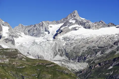
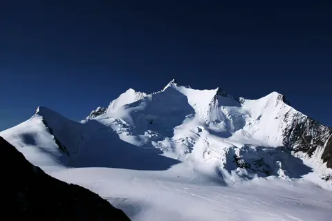
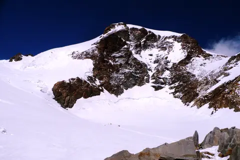
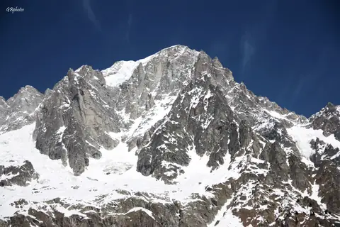
Questions
- How many 4000 m peaks are there in the Alps?
- The UIAA's official list, published in 1994, has 82 summits over 4,000 m; adding the subsidiary tops on its secondary list makes 128. peaks.fyi covers 80 of the 82, each with its normal route.
- What is the highest 4000er in the Alps?
- Mont Blanc (4,806 m), on the border of France and Italy. The way up is the normal route, the Goûter Route via the Bosses Ridge, graded PD-, about 9h 30m up over 2 days.
- What is the easiest 4000er in the Alps?
- By the grade of its normal route, Breithorn (4,160 m): the normal route, the South flank and west ridge from the Klein Matterhorn, graded F, about 2h 15m up. Easy is relative — every Alpine 4000er means glacier travel, altitude and fast-changing weather.
- When is the season for climbing the 4000ers?
- Mostly in July, when the huts are staffed and the routes are usually in condition. Many glacier routes are best early in the summer, while snow bridges are still firm; rock ridges are best once they are dry.
- Do you need a guide to climb a 4000er?
- Every Alpine 4000er involves glacier travel or climbing. Without experience of rope work and crevasse rescue, go with an IFMGA mountain guide; guides in Zermatt, Saas-Fee, Chamonix and Courmayeur run the easier ones as one- or two-day trips.