3000 m Peaks You Can Hike
Three thousand metres is where the mountains start to feel high — and you don't need a rope to get there. Every summit here has a hiking route with no glacier on the way, up to T3 on the Swiss hiking scale: steep, sometimes exposed paths where you may use your hands for balance, but no climbing.
The 29 peaks run from Heydar Peak (3,751 m) down to Stolovaia (3,003 m), most of them in the Alps, Caucasus Mountains and Sierra Nevada. Altitude still matters: walk up slowly, start early to beat afternoon storms, and expect snow on the path early and late in the season.
- Peaks
- 29
- Countries
- 7
The List
- Heydar Peak, 3,751 m, Greater Caucasus · AzerbaijanGreater Caucasus · AzerbaijanMountain hike3,751 m
From Khinalig via the Ateshgah camp · T3 · 13h 45m up · best Jul–Sep · GPX
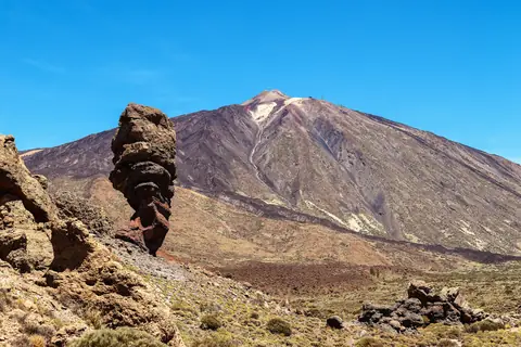
- Teide, 3,715 m, Macaronesia · SpainMacaronesia · SpainEasy walk3,715 m
From Montaña Blanca via the Refugio de Altavista and La Rambleta · T2 · 5h 45m up · best May–Jun · GPX
- Xınalıq Dağı, 3,713 m, Caucasus Mountains · AzerbaijanCaucasus Mountains · AzerbaijanMountain hike3,713 m
From Khinalig village · T3 · 13h 30m up · best Jul–Sep · GPX
- Babadağ, 3,629 m, Greater Caucasus · AzerbaijanGreater Caucasus · AzerbaijanMountain hike3,629 m
Pilgrims' route from Lahij via Gurbangah · T3 · 16h up · best Jul–Aug · GPX
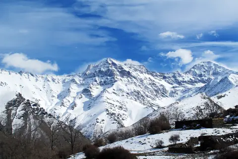
- Mulhacén, 3,479 m, Sierra Nevada · SpainSierra Nevada · SpainHike3,479 m
South ridge from Capileira via the Alto del Chorrillo · T2 · 9h up · best Jul–Sep · GPX
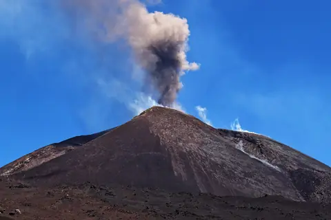
- Mount Etna, 3,403 m, Sicily · ItalySicily · ItalyMountain hike3,403 m
South side from Rifugio Sapienza via the Montagnola and Torre del Filosofo · T3 · 4h 30m up · best May–Jun · GPX
- Veleta, 3,396 m, Sierra Nevada · SpainSierra Nevada · SpainHike3,396 m
From Hoya de la Mora via Posiciones del Veleta · T2 · 3h 30m up · best Jul–Sep · GPX
- Mont Giusalet, 3,313 m, Ambin group · Italy, FranceAmbin group · Italy, FranceMountain hike3,313 m
From Bar Cenisio via Rifugio Avanzà · T3 · 7h 30m up · best Jul–Aug · GPX
- Punta Ramiere, 3,303 m, Massif du Queyras · Italy, FranceMassif du Queyras · Italy, FranceMountain hike3,303 m
From Valle Argentera via the Colle della Ramière · T3 · 5h 30m up · best Jul–Sep · GPX
- Monte Sobretta, 3,296 m, Sobretta-Gavia-Gruppe · ItalySobretta-Gavia-Gruppe · ItalyHike3,296 m
South side via the Valle dell'Alpe from Ponte dell'Alpe · T2 · 4h 30m up · best Jul–Aug · GPX
- Muttler, 3,294 m, Samnaun Alps · SwitzerlandSamnaun Alps · SwitzerlandMountain hike3,294 m
From Samnaun via Val Maisas, Rossbodenjoch and the north ridge · T3 · 5h 45m up · best Jul–Sep · GPX
- Petzeck, 3,283 m, Schober group · AustriaSchober group · AustriaMountain hike3,283 m
From Mörtschach via the Wangenitzseehütte and Kruckelkar · I- · T3 · 3h 15m up · best Jul–Aug · GPX
- Piz Languard, 3,262 m, Livigno Alps · SwitzerlandLivigno Alps · SwitzerlandMountain hike3,262 m
From Alp Languard via Val Languard and Chamanna Georgy · T3 · 3h 30m up · best Jul–Sep · GPX
- Sasseneire, 3,254 m, Pennine Alps · SwitzerlandPennine Alps · SwitzerlandMountain hike3,254 m
From the Moiry dam via the Col de Torrent and the SE ridge · T3 · 5h 45m up · best Jul–Sep · GPX
- Itkayabashi, 3,198 m, Caucasus Mountains · RussiaCaucasus Mountains · RussiaMountain hike3,198 m
From Bezengi via the Shile pass and the south ridge · T3 · 9h up · best Jul–Sep · GPX
- Scopi, 3,190 m, Medel-Terri Group · SwitzerlandMedel-Terri Group · SwitzerlandMountain hike3,190 m
From the Lukmanier Pass via Pouza dil Scopi and the west ridge · T3 · 5h up · best Jul–Sep · GPX
- Bastylam, 3,179 m, Greater Caucasus · RussiaGreater Caucasus · RussiaMountain hike3,179 m
From the Chanty-Argun valley by the south slopes · T3 · 8h 30m up · best Jul–Sep · GPX
- Mont Thabor, 3,178 m, massif du Mont Thabor · Francemassif du Mont Thabor · FranceHike3,178 m
From the Vallée Étroite via the Col des Méandes · T2 · 6h up · best Jul–Aug · GPX
- Vieux Chaillol, 3,163 m, massif du Champsaur · Francemassif du Champsaur · FranceMountain hike3,163 m
South side from Chaillol 1600 via the Col de la Pisse · T3 · 6h 30m up · best Jul–Sep · GPX
- Mekhtygen, 3,154 m, Greater Caucasus · RussiaGreater Caucasus · RussiaMountain hike3,154 m
North ridge from the Blue Lakes · T3 · 9h 45m up · best Jul–Sep · GPX
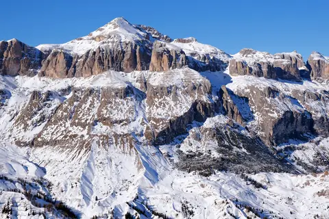
- Piz Boè, 3,152 m, Sella group · ItalySella group · ItalyMountain hike3,152 m
From Passo Pordoi via the Forcella Pordoi · T3 · 3h 45m up · best Jul–Sep · GPX
- Flüela Schwarzhorn, 3,146 m, Albula Alps · SwitzerlandAlbula Alps · SwitzerlandMountain hike3,146 m
Schwarzhornweg from the Flüela pass road via the Schwarzhornfurgga and the south ridge · T3 · 3h 15m up · best Jul–Sep · GPX
- Mont Chaberton, 3,132 m, Mont Cenis · FranceMont Cenis · FranceMountain hike3,132 m
From Montgenèvre via the Col du Chaberton · T3 · 5h 15m up · best Jul–Sep · GPX
- Mont Buet, 3,096 m, Gruppo del Buet · FranceGruppo del Buet · FranceMountain hike3,096 m
From Le Buet via the Vallon de Bérard · T3 · 7h up · 2 days · best Jul–Aug · GPX
- Bruschghorn, 3,056 m, Spluga Mountains · SwitzerlandSpluga Mountains · SwitzerlandMountain hike3,056 m
From Tguma via Sur Tuf and point 2806 · T3 · 4h 15m up · best Jul–Sep · GPX
- Mont Pelat, 3,051 m, Maritime Alps · FranceMaritime Alps · FranceHike3,051 m
From the Laus car park via the Barres and Combe du Pelat · T2 · 4h 15m up · best Jul–Sep · GPX
- Tête de Siguret, 3,032 m, chaîne Corborant-Ténibre-Enchastraye · Francechaîne Corborant-Ténibre-Enchastraye · FranceMountain hike3,032 m
From Certamussat via the Vallon de la Duyère and Vallon Long · T3 · 6h 30m up · best Jul–Sep · GPX
- Dzhufudag, 3,015 m, Caucasus Mountains · RussiaCaucasus Mountains · RussiaMountain hike3,015 m
From Burshag, direct · T3 · 4h 30m up · best Jul–Sep · GPX
- Stolovaia, 3,003 m, Khokh Range · RussiaKhokh Range · RussiaMountain hike3,003 m
From Beyni via the Myat-Loam saddle and the Myat-Seli sanctuary · T3 · 6h 30m up · best Jul–Sep · GPX
Questions
- What is the highest mountain you can hike in Europe?
- Of the peaks on peaks.fyi, Heydar Peak (3,751 m): the normal route from Khinalig via the Ateshgah camp, graded T3, about 13h 45m up. It needs a permit: State Border Service permit, Shahdag National Park entry and Ministry of Emergency Situations (FHN) registration.
- Which 3000 m peaks are quickest to hike?
- Flüela Schwarzhorn (about 3h 15m up), Petzeck (about 3h 15m up) and Veleta (about 3h 30m up), from the start of their routes.
- Do you need experience to hike a 3000 m peak?
- You need fitness, good boots and mountain sense rather than technical skills: the paths are steep and can be exposed, and the weather above 3,000 m changes fast. Snow can lie on these paths until early summer.