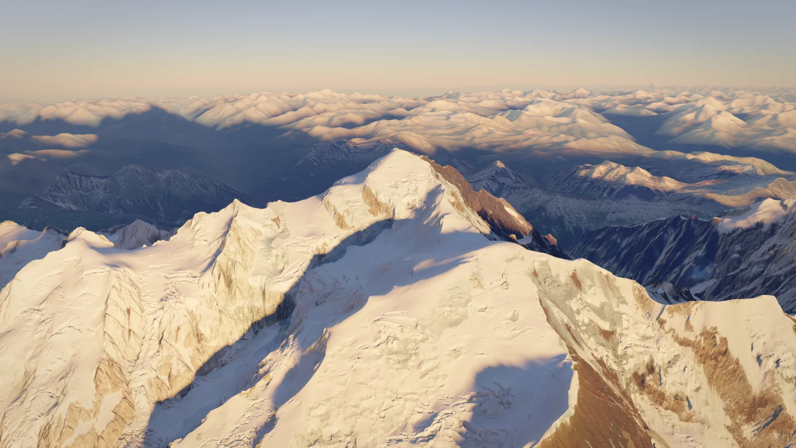
Mont Blanc
4,806 m
France, Italy
Also known as Монблан, Λευκό Όρος, +4Also known as
Монблан · Λευκό Όρος · Hvítfjall · Monte Bianco · მონბლანი · Mont Blanc / Monte Bianco
- Elevation
- 4,806 m
- Prominence
- 4,692 m
- Difficulty
- 5/10
- Easy alpine
- Best Season
- Jul
- Routes
- 2
Routes
2The French normal route from Saint-Gervais: tramway to the Nid d'Aigle, a rocky climb across the rockfall-prone Grand Couloir to the Goûter hut (3,815 m), then glacier slopes over the Dôme du Goûter and the narrow Bosses ridge to the summit. Technically modest but long, high, crowded and exposed to rockfall and severe weather.
Elevation Profile
approximate line- Distance
- 8.9 km
- one way
- Ascent
- +2,486 m
- −52 m lost on the way up
- High Point
- 4,807 m
- Time Up
- 9h 30m
- DIN 33466
- Time Down
- 6h 15m
- DIN 33466 · same way back
Take the Tramway du Mont-Blanc from Le Fayet (Saint-Gervais) or the Bellevue cable car from Les Houches to the Nid d'Aigle terminus (2,372 m). A well-used path climbs past the Baraque forestière des Rognes and across the small Tête Rousse glacier to the Refuge de Tête Rousse (about 3,167 m), 2–3 hours. From there a snow slope leads to the crossing of the Grand Couloir, usually equipped with a cable: cross it quickly, early in the day, as stonefall is frequent and has killed many climbers, most recently two in July 2026. Above, a rocky rib with cables and iron steps leads to the Goûter hut on the Aiguille du Goûter (2½–3½ hours from Tête Rousse). Summit day starts around 02:00. A short steep step gains a snow ridge leading on to the west slopes of the Dôme du Goûter; pass below its summit, drop to the col (about 4,250 m) and climb to the Vallot emergency shelter (4,362 m), about 2 hours. In poor visibility the broad slopes around the Dôme are hard to navigate: a map, compass and GPS track are essential. Above, the Arête des Bosses climbs over successive humps, the first quite steep (about 35°) and the upper ridge narrow and often windy, to the summit at about 4,808 m (2 hours from the Vallot). Descend the same way, recrossing the Grand Couloir as early as possible. Some parties start from Tête Rousse around 01:30 to avoid crossing the couloir in the afternoon, at the cost of a 1,600 m summit day. In good conditions with a track in place the upper route feels easy; in wind, cloud or cold it becomes serious very quickly.
Start
Nid d'Aigle2,371 m
- Tramway du Mont-Blanc (Le Fayet – Nid d'Aigle); Bellevue cable car from Les Houches
- Train to Saint-Gervais-les-Bains-Le Fayet, then the Tramway du Mont-Blanc to the Nid d'Aigle (2026 season from 13 June); or bus/train to Les Houches and the Bellevue cable car to join the tramway.
Stages
| Day | Stage | km | m ascent | m descent | Time |
|---|---|---|---|---|---|
| 1 | Nid d'Aigle → Refuge du Goûter | 4.5 | 1,465 | 0 | 5h 27m |
| 2 | Refuge du Goûter → Mont Blanc | 4.3 | 1,020 | 52 | 4h 02m |
Waypoints
- Station: Nid d'Aigle2,371 m
- Hut: Refuge de Tête Rousse3,165 m
- Hut: Refuge du Goûter3,833 m
- Shoulder: Dôme du Goûter4,304 m
Route passes just below the summit (not on route line)
- Bivouac: Refuge Vallot4,358 m
Emergency shelter only
- Shoulder: Les Bosses4,521 m
- Summit: Mont Blanc4,806 m
Key Passages
- Grand Couloir crossing (rockfall)
- Rocky rib with cables between Tête Rousse and the Goûter hut
- Dôme du Goûter slopes (navigation in poor visibility)
- Arête des Bosses (narrow, windy snow ridge)
Equipment
0/13 packedDownloads
Route confidence 85%Overview
At about 4,808 m the highest summit in the Alps, on the French–Italian border above Chamonix, Saint-Gervais and Courmayeur. The normal routes are technically modest glacier climbs, but altitude, weather, crevasses and rockfall in the Grand Couloir make it a serious two- to three-day undertaking.
Mont Blanc (Monte Bianco in Italian) is a broad ice dome at the centre of a massif shared by France, Italy and Switzerland, with the Chamonix valley to the north-west and Courmayeur and Val Veny to the south-east. Its summit is a permanent ice cap whose height changes with snow accumulation: surveys have measured between about 4,805 and 4,808 m in recent years.
Two routes carry most traffic. The Goûter route (the 'Voie Royale') from Saint-Gervais is graded around PD- and involves a rocky climb to the Goûter hut, then high glacier slopes and the narrow Bosses ridge. The Three Monts route from the Aiguille du Midi is a little harder and steeper, crossing the shoulders of Mont Blanc du Tacul and Mont Maudit. Neither requires hard technical climbing, but both reach 4,800 m, where wind chill, whiteout and altitude sickness are routine problems, and both involve rope work on crevassed glaciers.
The mountain has a high accident rate: Wikipedia cites roughly 10–20 deaths a year, with 14 deaths in about 20,000 attempts in 2017. The Grand Couloir on the Goûter route is the main single hazard, and hot, dry summers have made it worse; in 2026 two climbers died there in July and the huts on the route were closed from 11 to 26 August. Access to the Goûter route is regulated by a prefectoral decree requiring a hut reservation.
Climbing Notes
You need solid glacier skills (roped travel, crampon technique on 35–45° slopes, crevasse rescue) and good fitness for a 1,000–1,600 m summit day above 3,800 m. Acclimatisation is essential: spend several days beforehand climbing and sleeping above 3,000 m, for example on the Gran Paradiso, the Breithorn or around the Aiguille du Midi. Many climbers use an IFMGA guide; guided programmes typically include two or three acclimatisation days before the summit attempt.
A typical Goûter itinerary is: tramway to the Nid d'Aigle, climb to Tête Rousse or the Goûter hut on day one, summit and descend to the valley or to Tête Rousse on day two. Cross the Grand Couloir early, one at a time, without stopping, and avoid it in hot afternoons. On the Three Monts route, sleep at the Cosmiques hut after the Aiguille du Midi cable car and start around 01:00.
Book the Goûter, Tête Rousse or Nid d'Aigle huts as soon as reservations open (online only, named and non-transferable); without a reservation you may not climb above the Tête Rousse glacier. Carry the Saint-Gervais mandatory kit, your booking confirmation and ID. Check the forecast for wind at 4,800 m as well as precipitation, and follow announcements from the Saint-Gervais mairie and the Haute-Savoie prefecture, as huts or sections are now sometimes closed in heat waves.
History
Jacques Balmat and the doctor Michel-Gabriel Paccard made the first ascent on 8 August 1786, prompted by a prize offered by the Genevan scientist Horace-Bénédict de Saussure; the date is often taken as the birth of modern mountaineering. Marie Paradis became the first woman on the summit in 1808, followed by Henriette d'Angeville in 1838. The first complete traverse of the Three Monts route was made on 13 August 1863. The current Goûter hut opened in 2013; the old hut, unused since 2008, was dismantled in summer 2026 for re-erection in Saint-Gervais. France and Italy have never agreed the border on the summit: France claims the whole summit, Italy places the border on the watershed.
Season
Best Jul- January: Not advisable
- February: Not advisable
- March: Not advisable
- April: Possible
- May: Possible
- June: Good
- July: Best (best window)
- August: Good
- September: Good
- October: Possible
- November: Not advisable
- December: Not advisable
- Jan
- Winter; huts unstaffed; very cold and windy
- Feb
- Winter; ski-mountaineering ascents only
- Mar
- Ski-mountaineering ascents for experienced parties
- Apr
- Spring ski-mountaineering season (Grands Mulets, Three Monts); not a walking ascent
- May
- Goûter and Tête Rousse huts open in late May; much snow, tramway not yet running
- Jun
- More snow cover in the Grand Couloir; tramway from mid-June
- Jul
- Main season; watch for heat waves and Grand Couloir rockfall
- Aug
- Busy; heat can make the Grand Couloir dangerous (huts closed 11–26 August 2026)
- Sep
- Quieter, colder; good in stable weather; shorter days
- Oct
- Huts close in early October; winter conditions arrive
- Nov
- Winter conditions
- Dec
- Winter conditions
Access & Permits
- Permits
- Hut reservation on the Goûter route (prefectoral decree)Required
Under a Haute-Savoie prefectoral decree (first introduced in 2019, current version dated 15 June 2020), climbers on the Goûter route beyond the Tête Rousse glacier must hold a personal reservation at one of the route's huts (Nid d'Aigle, Tête Rousse, Goûter) and carry the booking confirmation and a valid identity document, which may be checked. Reservations are online only, name each participant and cannot be transferred or resold.
montblanc.ffcam.fr
- Hut Booking
- Goûter and Tête Rousse: online only via montblanc.ffcam.fr; places are released in several waves and sell out quickly. Nid d'Aigle hut: no longer run by FFCAM, contact the hut directly. Cosmiques hut: reservation required, contact the hut directly.
- Fees
- Hut fees for the Goûter, Tête Rousse, Nid d'Aigle or Cosmiques huts
- Tramway du Mont-Blanc or Bellevue cable car ticket (Goûter route)
- Aiguille du Midi cable car ticket (Three Monts route)
- Goûter hut: silk liner mandatory, EUR 10 if bought at the hut
- Rules
- Goûter route: hut reservation, booking proof and ID required above the Tête Rousse glacier (prefectoral decree of 15 June 2020)
- Saint-Gervais municipal ordinance (August 2017): minimum equipment mandatory on the Goûter route, including crampons, ice axe, harness, crevasse-rescue kit, rope, GPS or altimeter, warm and waterproof clothing, sunglasses and goggles; offenders can be fined
- Camping and bivouacking are prohibited in the classified Mont Blanc site, except at the Tête Rousse base camp; a natural-habitat protection decree (APPHN) has covered the area since 1 October 2020
- The Vallot hut (4,362 m) is an emergency shelter only
- Huts and route sections can be closed by municipal decree in dangerous conditions, as in 11–26 August 2026 (Tête Rousse and Goûter) and for two days in late May 2026 (Tête Rousse–Goûter section, rock and ice clearing)
- Getting There
Chamonix-Mont-Blanc; Saint-Gervais-les-Bains and Les Houches for the Goûter route; Courmayeur on the Italian side
Geneva (GVA)
- Train to Saint-Gervais-les-Bains-Le Fayet, then the Tramway du Mont-Blanc to the Nid d'Aigle (2026 season from 13 June)
- Les Houches: Bellevue cable car to connect with the tramway at Bellevue
- Chamonix: Mont-Blanc Express train or bus, then the Aiguille du Midi cable car for the Three Monts route
- Road access from Geneva via the A40 motorway to Le Fayet, Les Houches and Chamonix
Hazards
- Glacier
- Crevasses
- Rockfall
- Altitude
- Weather
- Avalanche
- Exposure
Huts & Shelters
5- 2,372 m
Refuge du Nid d'AigleRefuge
- 3,167 m
Refuge de Tête RousseRefuge
74 beds · Late May to early October (29 May – 3 October 2026); base camp tents nearby
- 3,613 m
Refuge des CosmiquesRefuge
148 beds · Staffed mid-February to mid-October; the small Abri Simond nearby is unlocked in winter
- 3,815 m
Refuge du GoûterRefuge
120 beds · Late May to early October (30 May – 4 October 2026); winter room outside the season
- 4,362 m
Refuge VallotBivouac
Year-round, emergency use only