Mountains of France
France's highest mountain is Mont Blanc (4,806 m), on the border with Italy. peaks.fyi covers 114 peaks in France, in the Alps, Pyrenees and Massif Central, 25 of them over 4,000 m.
40 have a plain hiking route, the highest being Mont Giusalet (3,313 m); 57 need alpine climbing, scrambling or glacier skills.
Most of France's peaks are at their best from July to September; each row shows the best months for that peak.
- Peaks
- 114
- With GPX
- 114
Peaks, Highest First
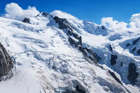
- Mont Blanc, 4,806 m, Mont Blanc massif · France, ItalyMont Blanc massif · France, ItalyEasy alpine4,806 m
Goûter Route via the Bosses Ridge · PD- · 9h 30m up · 2 days · best Jul · GPX
- Mont Blanc de Courmayeur, 4,748 m, Mont Blanc massif · France, ItalyMont Blanc massif · France, ItalyEasy alpine4,748 m
Goûter Route to Mont Blanc, then the ridge over the Col Major · PD- · 9h 45m up · 2 days · best Jul · GPX
- Mont Maudit, 4,465 m, Mont Blanc massif · France, ItalyMont Blanc massif · France, ItalyEasy alpine4,465 m
North face via the Col du Mont Maudit · PD+ · 6h 15m up · 2 days · best Jul · GPX
- Dôme du Goûter, 4,304 m, Mont Blanc massif · France, ItalyMont Blanc massif · France, ItalyEasy alpine4,304 m
Via the Aiguille du Goûter · PD · 7h 15m up · 2 days · best Jul · GPX
- Mont Blanc du Tacul, 4,248 m, Mont Blanc massif · FranceMont Blanc massif · FranceEasy alpine4,248 m
North-west flank from the Aiguille du Midi · PD · 4h 30m up · 2 days · best Jun–Jul · GPX
- Grandes Jorasses, 4,208 m, Mont Blanc massif · Italy, FranceMont Blanc massif · Italy, FranceAlpine climb4,208 m
Normal route from Planpincieux via the Boccalatte hut, Rocher du Reposoir and Rochers Whymper · AD · IV · 9h 45m up · 2 days · best Jul · GPX
- Punta Whymper, 4,184 m, Mont Blanc massif · Italy, FranceMont Blanc massif · Italy, FranceAlpine climb4,184 m
Grandes Jorasses normal route via the Rocher du Reposoir and Rochers Whymper · AD · III+ · 10h up · 2 days · best Jul · GPX
- Aiguille Verte, 4,122 m, Mont Blanc massif · FranceMont Blanc massif · FranceAlpine climb4,122 m
Whymper Couloir · AD · 10h 30m up · 2 days · best Jun · GPX
- L'Isolée, 4,114 m, Mont Blanc massif · FranceMont Blanc massif · FranceHard alpine4,114 m
Traverse of the Aiguilles du Diable from the Col du Diable · D+ · V+ · 6h up · 2 days · best Jul–Aug · GPX
- Punta Croz, 4,110 m, Mont Blanc massif · Italy, FranceMont Blanc massif · Italy, FranceAlpine climb4,110 m
Grandes Jorasses normal route to Pointe Whymper, then the summit ridge west to Pointe Croz · AD · III · 9h 45m up · 2 days · best Jul · GPX
- Pointe Carmen, 4,109 m, Mont Blanc massif · FranceMont Blanc massif · FranceHard alpine4,109 m
Traverse of the Aiguilles du Diable from the Col du Diable · D+ · V · 5h 45m up · 2 days · best Jul–Aug · GPX
- Barre des Écrins, 4,102 m, chaine Écrins-Grande Ruine-Agneaux · Francechaine Écrins-Grande Ruine-Agneaux · FranceEasy alpine4,102 m
Normal route via the Glacier Blanc, north face and west ridge · PD · III · 12h up · 2 days · best Jun–Jul · GPX
- Grande Rocheuse, 4,102 m, Mont Blanc massif · FranceMont Blanc massif · FranceAlpine climb4,102 m
Couloir Whymper from the Couvercle hut · AD+ · 10h 15m up · 2 days · best May–Jun · GPX
- Pointe Médiane, 4,097 m, Mont Blanc massif · FranceMont Blanc massif · FranceHard alpine4,097 m
Arête du Diable from the Col du Diable · D+ · V · 5h 30m up · 2 days · best Jul–Aug · GPX
- Pointe Chaubert, 4,074 m, Mont Blanc massif · FranceMont Blanc massif · FranceHard alpine4,074 m
Arête du Diable from the Col du Diable · D+ · IV+ · 5h 30m up · 2 days · best Jul–Aug · GPX
- Punta Margherita, 4,066 m, Mont Blanc massif · Italy, FranceMont Blanc massif · Italy, FranceAlpine climb4,066 m
Grandes Jorasses normal route to Pointe Whymper, then the summit ridge west to Pointe Marguerite · AD · IV · 10h up · 2 days · best Jul–Aug · GPX
- Corne du Diable, 4,064 m, Mont Blanc massif · FranceMont Blanc massif · FranceAlpine climb4,064 m
Col du Diable south-west couloir and north-west ridge · AD · III+ · 5h 30m up · 2 days · best Jul · GPX
- Aiguille de Bionnassay, 4,052 m, Mont Blanc massif · France, ItalyMont Blanc massif · France, ItalyAlpine climb4,052 m
South ridge from the Refuge Durier · AD · II · 11h 45m up · 2 days · best Jun–Jul · GPX
- Punta Elena, 4,045 m, Mont Blanc massif · Italy, FranceMont Blanc massif · Italy, FranceAlpine climb4,045 m
Grandes Jorasses normal route to Pointe Whymper, then the summit ridge west over Pointe Croz · AD · IV · 10h 45m up · 2 days · best Jul · GPX
- Aiguille du Jardin, 4,035 m, Mont Blanc massif · FranceMont Blanc massif · FranceAlpine climb4,035 m
Couloir Whymper, Grande Rocheuse and the W ridge via the Col Armand Charlet · AD+ · III · 10h 45m up · 2 days · best Jun · GPX
- Dôme de Neige des Écrins, 4,015 m, chaine Écrins-Grande Ruine-Agneaux · Francechaine Écrins-Grande Ruine-Agneaux · FranceAlpine hike4,015 m
North face from the Refuge des Écrins · F+ · 11h 45m up · 2 days · best May–Jul · GPX
- Dôme de Rochefort, 4,015 m, Mont Blanc massif · Italy, FranceMont Blanc massif · Italy, FranceAlpine climb4,015 m
Rochefort Ridge from the Rifugio Torino · AD · III · 6h up · 2 days · best Jul · GPX
- Dent du Géant, 4,013 m, Mont Blanc massif · France, ItalyMont Blanc massif · France, ItalyAlpine climb4,013 m
South-west face by the Burgener Slabs · AD+ · IV+ · 3h 45m up · 2 days · best Jul–Aug · GPX
- Aiguille de Rochefort, 4,001 m, Mont Blanc massif · Italy, FranceMont Blanc massif · Italy, FranceAlpine climb4,001 m
Rochefort Ridge from the Rifugio Torino · AD · III · 4h 30m up · 2 days · best Jul · GPX
- Les Droites, 4,000 m, Mont Blanc massif · FranceMont Blanc massif · FranceAlpine climb4,000 m
East buttress from the Talèfre glacier · AD+ · 10h up · 2 days · best Jun · GPX
- Meije, 3,983 m, chaine Meije-Râteau-Soreiller · Francechaine Meije-Râteau-Soreiller · FranceAlpine climb3,983 m
Promontoire Ridge and south face · AD · IV- · 9h 30m up · 2 days · best Jul–Aug · GPX
- Ailefroide, 3,954 m, chaine Pelvoux-Bans-Sirac · Francechaine Pelvoux-Bans-Sirac · FranceEasy alpine3,954 m
South-east spur from the Refuge du Sélé · PD · III · 14h 30m up · 2 days · best Jul–Aug · GPX
- Mont Pelvoux, 3,943 m, chaine Pelvoux-Bans-Sirac · Francechaine Pelvoux-Bans-Sirac · FranceEasy alpine3,943 m
Couloir Coolidge from the Refuge du Pelvoux · PD+ · 9h 30m up · 2 days · best Jun–Jul · GPX
- Pic Sans Nom, 3,913 m, chaine Pelvoux-Bans-Sirac · Francechaine Pelvoux-Bans-Sirac · FranceEasy alpine3,913 m
South-east face from the Refuge du Pelvoux via the Glacier de Sialouze · PD · 9h 45m up · 2 days · best Jun · GPX
- Aiguille d'Argentière, 3,898 m, Mont Blanc massif · Switzerland, FranceMont Blanc massif · Switzerland, FranceEasy alpine3,898 m
West flank and north-west ridge · PD+ · 4h up · best Apr · GPX
- Aiguille de Triolet, 3,870 m, Mont Blanc massif · Italy, FranceMont Blanc massif · Italy, FranceEasy alpine3,870 m
From the Couvercle hut via the Talèfre glacier and the Col de Triolet · PD · 9h 30m up · 2 days · best Jul · GPX
- Grande Casse, 3,855 m, Vanoise massif · FranceVanoise massif · FranceEasy alpine3,855 m
Grands Couloirs from the Refuge du Col de la Vanoise · PD+ · 9h up · 2 days · best Apr · GPX
- Aiguille du Midi, 3,842 m, Mont Blanc massif · FranceMont Blanc massif · FranceAlpine climb3,842 m
Arête des Cosmiques · AD · IV- · 2h 45m up · best Jun–Jul · GPX
- Tour Noir, 3,836 m, Mont Blanc massif · Switzerland, FranceMont Blanc massif · Switzerland, FranceEasy alpine3,836 m
From the Cabane de l'A Neuve via the Passage d'Argentière and SE flank · PD · II · 9h up · 2 days · best Jul–Aug · GPX
- Aiguille du Chardonnet, 3,824 m, Mont Blanc massif · Switzerland, FranceMont Blanc massif · Switzerland, FranceAlpine climb3,824 m
From the Refuge Albert 1er via the Glacier de l'Épaule and west ridge · AD- · 8h 30m up · 2 days · best Jun–Jul · GPX
- Mont Dolent, 3,820 m, Mont Blanc massif · Switzerland, France, ItalyMont Blanc massif · Switzerland, France, ItalyEasy alpine3,820 m
South flank and SE ridge from Bivacco Fiorio · PD+ · II · 7h 45m up · 2 days · best Jun–Jul · GPX
- Mont Pourri, 3,779 m, Vanoise massif · FranceVanoise massif · FranceEasy alpine3,779 m
Glacier du Geay from the Refuge du Mont Pourri · PD · 9h 15m up · 2 days · best Jul · GPX
- Pointe de Charbonnel, 3,752 m, Gruppo del Charbonnel · FranceGruppo del Charbonnel · FranceEasy alpine3,752 m
North face from Les Vincendières · PD · II+ · 7h 15m up · best Jul · GPX
- Aiguille de la Grande Sassière, 3,751 m, Graian Alps · Italy, FranceGraian Alps · Italy, FranceAlpine hike3,751 m
From the Barrage du Saut by the south-west and west ridge · F · T4 · 9h up · best Jul–Sep · GPX
- Dent Parrachée, 3,697 m, Vanoise massif · FranceVanoise massif · FranceEasy alpine3,697 m
South side of the Col de la Dent Parrachée and west ridge over the Pointe de la Fournache · PD- · II · 6h 45m up · 2 days · best Jun–Jul · GPX
- Grand Roc Noir, 3,582 m, Iseran massif · FranceIseran massif · FranceEasy alpine3,582 m
South-east side from the Refuge de Vallonbrun via the Pierre aux Pieds · PD+ · III · 7h 30m up · 2 days · best Jul · GPX
- Aiguille de Péclet, 3,562 m, Vanoise massif · FranceVanoise massif · FranceEasy alpine3,562 m
West side by the Glacier de Péclet from Val Thorens · PD- · 5h 30m up · best Apr–May · GPX
- Aiguilles d'Arves, 3,514 m, Arves massif · FranceArves massif · FranceHard alpine3,514 m
Aiguille Méridionale: S face from the Col Lombard · AD+ · V · 7h 30m up · 2 days · best Jul–Aug · GPX
- Aiguille de Scolette, 3,506 m, Gruppo della Pierre Menue · France, ItalyGruppo della Pierre Menue · France, ItalyEasy alpine3,506 m
From the Rochemolles dam via the Colle della Pelouse, SW ridge and west face · PD · 6h 15m up · best Jul–Aug · GPX
- Pic Bayle, 3,465 m, Grandes Rousses · FranceGrandes Rousses · FranceAlpine hike3,465 m
By the Glacier du Grand Sablat from the Col de Sarenne · F · 8h up · best Jun–Jul · GPX
- Sommet de Bellecôte, 3,417 m, Vanoise massif · FranceVanoise massif · FranceEasy alpine3,417 m
South side by the Refuge de Plaisance and the Glacier du Cul du Nant · PD- · II · 7h 15m up · 2 days · best Jul · GPX
- Aiguille de Chambeyron, 3,412 m, Chambeyron Mountains · FranceChambeyron Mountains · FranceEasy alpine3,412 m
South face via the Couloir Gastaldi and Brèche Nérot-Vernet · PD- · III- · 6h 15m up · 2 days · best Jul–Sep · GPX
- Pics de la Font Sancte, 3,387 m, Font Sance Massif · FranceFont Sance Massif · FranceEasy alpine3,387 m
Pic Nord by the west couloir from the Val d'Escreins · T5 · 10h 30m up · best Jun · GPX
- Pic de Rochebrune, 3,324 m, Massif du Queyras · FranceMassif du Queyras · FranceEasy alpine3,324 m
From the Col d'Izoard via the Col Perdu and Col des Portes · F+ · III · 4h 30m up · best Jul–Sep · GPX
- Mont Giusalet, 3,313 m, Ambin group · Italy, FranceAmbin group · Italy, FranceMountain hike3,313 m
From Bar Cenisio via Rifugio Avanzà · T3 · 7h 30m up · best Jul–Aug · GPX
- Punta Ramiere, 3,303 m, Massif du Queyras · Italy, FranceMassif du Queyras · Italy, FranceMountain hike3,303 m
From Valle Argentera via the Colle della Ramière · T3 · 5h 30m up · best Jul–Sep · GPX
- Vignemale, 3,299 m, Massif de Vignemale · France, SpainMassif de Vignemale · France, SpainAlpine hike3,299 m
From the Barrage d'Ossoue via Refuge de Bayssellance and the Ossoue Glacier · F · II · 6h 45m up · 2 days · best Jul · GPX
- Grand Galibier, 3,228 m, Massif des Cerces · FranceMassif des Cerces · FranceAlpine hike3,228 m
From Plan Lachat via the Col de la Ponsonnière and Col Termier · F · II · T4 · 5h 45m up · best Aug–Sep · GPX
- Rocca Bernauda, 3,225 m, Massif de la Roche Bernaude · Italy, FranceMassif de la Roche Bernaude · Italy, FranceAlpine hike3,225 m
North ridge from Valle Stretta via the Colle della Gran Somma · F+ · II- · 6h 30m up · best Jul–Aug · GPX
- Perdiguero, 3,222 m, Pyrenees · France, SpainPyrenees · France, SpainAlpine hike3,222 m
From the Granges d'Astau via the Refuge du Portillon and the Col Supérieur de Litérole · F · II · 9h 30m up · 2 days · best Aug–Sep · GPX
- Pic Long, 3,192 m, Néouvielle massif · FranceNéouvielle massif · FranceEasy alpine3,192 m
From the Cap de Long dam via Pic Badet and the Hourquette du Pic Long · PD+ · III- · 5h 15m up · best Jul–Sep · GPX
- Mont Thabor, 3,178 m, massif du Mont Thabor · Francemassif du Mont Thabor · FranceHike3,178 m
From the Vallée Étroite via the Col des Méandes · T2 · 6h up · best Jul–Aug · GPX
- Pic Schrader, 3,177 m, Batchimale massif · France, SpainBatchimale massif · France, SpainAlpine hike3,177 m
From the Refugio de Viadós via the Paso de la Gatera and the W slope · F · T4 · 6h up · best Jul–Sep · GPX
- Vieux Chaillol, 3,163 m, massif du Champsaur · Francemassif du Champsaur · FranceMountain hike3,163 m
South side from Chaillol 1600 via the Col de la Pisse · T3 · 6h 30m up · best Jul–Sep · GPX
- Signal du Petit Mont-Cenis, 3,162 m, Ambin group · FranceAmbin group · FranceAlpine hike3,162 m
From the Refuge du Petit Mont-Cenis via the Col de Sollières and the SW ridge · F · T4 · 4h 15m up · best Jul–Aug · GPX
- Pic Ouest de Combeynot, 3,155 m, Massif des Écrins · FranceMassif des Écrins · FranceEasy alpine3,155 m
From Les Boussardes via the Lac de Combeynot and the Brèche de Combeynot · F · I · T5 · 8h 45m up · best Jul–Sep · GPX
- Balaïtous, 3,144 m, Balaitus Massif · France, SpainBalaitus Massif · France, SpainEasy alpine3,144 m
From the Porte d'Arrens via the Refuge de Larribet and the Grande Diagonale · F · II · T5 · 9h 15m up · 2 days · best Jul–Sep · GPX
- Pica d'Estats, 3,143 m, Montcalm Massif · France, SpainMontcalm Massif · France, SpainAlpine hike3,143 m
From the Vall Ferrera via the Port de Sotllo · F · T3 · 6h 45m up · best Jul–Sep · GPX
- Cime du Gélas, 3,143 m, Gruppo Gelas-Grand Capelet · France, ItalyGruppo Gelas-Grand Capelet · France, ItalyEasy alpine3,143 m
East couloir via the Madone de Fenestre · F · T5 · 9h 45m up · 2 days · best Jun–Jul · GPX
- Pic de la Munia, 3,133 m, Massif de la Munia · Spain, FranceMassif de la Munia · Spain, FranceEasy alpine3,133 m
Spanish normal route from Pietramula via the Munia lakes and the Paso del Gato · F · II+ · T5 · 5h up · best Jul–Sep · GPX
- Mont Chaberton, 3,132 m, Mont Cenis · FranceMont Cenis · FranceMountain hike3,132 m
From Montgenèvre via the Col du Chaberton · T3 · 5h 15m up · best Jul–Sep · GPX
- Mont Buet, 3,096 m, Gruppo del Buet · FranceGruppo del Buet · FranceMountain hike3,096 m
From Le Buet via the Vallon de Bérard · T3 · 7h up · 2 days · best Jul–Aug · GPX
- Mont Pelat, 3,051 m, Maritime Alps · FranceMaritime Alps · FranceHike3,051 m
From the Laus car park via the Barres and Combe du Pelat · T2 · 4h 15m up · best Jul–Sep · GPX
- Grand Bérard, 3,046 m, Parpaillon Massif · FranceParpaillon Massif · FranceAlpine hike3,046 m
From Sainte-Anne via the Vallon du Bérard and the Pas du Reverdillon · T4 · 5h 30m up · best Jul–Sep · GPX
- Culfreda (Pic de Batoua), 3,034 m, Batchimale massif · Spain, FranceBatchimale massif · Spain, FranceAlpine hike3,034 m
From the Refugio de Tabernés via the Puerto de la Madera and Punta Cabalera · F · I+ · T3 · 5h 45m up · best Jul–Sep · GPX
- Tête de Siguret, 3,032 m, chaîne Corborant-Ténibre-Enchastraye · Francechaîne Corborant-Ténibre-Enchastraye · FranceMountain hike3,032 m
From Certamussat via the Vallon de la Duyère and Vallon Long · T3 · 6h 30m up · best Jul–Sep · GPX
- Roignais, 2,995 m, Beaufortain Mountains · FranceBeaufortain Mountains · FranceEasy alpine2,995 m
North-east couloir from Le Chapelet · F · T5 · 4h 15m up · best Jul · GPX
- Grand Pic de Belledonne, 2,977 m, Belledonne · FranceBelledonne · FranceEasy alpine2,977 m
From Pré Marcel via the Refuge Jean Collet, Lac Blanc and the Col de la Balmette · PD · III · 8h up · 2 days · best Jul–Aug · GPX
- Pic Carlit, 2,921 m, Carlit Massif · FranceCarlit Massif · FranceMountain hike2,921 m
From the Lac des Bouillouses via the Carlit lakes and the east ridge · T3 · 4h up · best Jul–Sep · GPX
- Puigmal, 2,910 m, Pyrenees · Spain, FrancePyrenees · Spain, FranceHike2,910 m
From the Collada de Fontalba via the Cim de la Dou and Cim del Borrut · T2 · 3h 30m up · best Jul–Sep · GPX
- Pic du Midi d'Ossau, 2,884 m, Pyrenees · FrancePyrenees · FranceEasy alpine2,884 m
Voie normale via Refuge de Pombie and the three chimneys · PD · III+ · 5h 15m up · best Jul–Sep · GPX
- Pic du Midi de Bigorre, 2,877 m, Pic du Midi de Bigorre massif · FrancePic du Midi de Bigorre massif · FranceHike2,877 m
From the Toue hairpin via the Lac d'Oncet and the Col de Sencours · T2 · 4h up · best Jul–Sep · GPX
- Le Taillefer, 2,857 m, Taillefer Massif · FranceTaillefer Massif · FranceMountain hike2,857 m
Crête de Brouffier and Pas de la Mine from the Poursollet road · T3 · 5h up · best Jul–Sep · GPX
- Grande Tête de l'Obiou, 2,789 m, Dévoluy Mountains · FranceDévoluy Mountains · FranceEasy alpine2,789 m
Voie normale from the Chalet des Baumes via the Col de l'Obiou · T5 · 5h 15m up · best Jul–Sep · GPX
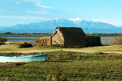
- Canigó, 2,784 m, Massís del Canigó · FranceMassís del Canigó · FranceMountain hike2,784 m
From Los Masos de Valmanya via Refuge des Cortalets and Pic Joffre · T3 · 7h 30m up · 2 days · best Jul–Sep · GPX
- Pointe Percée, 2,750 m, Aravis Range · FranceAravis Range · FranceEasy alpine2,750 m
Voie normale from the Col des Annes via the Refuge de Gramusset · PD · II · T5 · 4h 15m up · best Jul–Sep · GPX
- Pic de Bure, 2,709 m, Dévoluy Mountains · FranceDévoluy Mountains · FranceMountain hike2,709 m
Via the Combe Ratin and the Plateau de Bure · T3 · 5h 15m up · best Sep–Oct · GPX
- Monte Cinto, 2,706 m, Monte Cinto massif · FranceMonte Cinto massif · FranceAlpine hike2,706 m
From Lozzi via the Refuge de l'Ercu and the south shoulder · F · T4 · 7h 30m up · best Jul–Sep · GPX
- Punta Marguareis, 2,651 m, Catena Marguareis-Mongioie · Italy, FranceCatena Marguareis-Mongioie · Italy, FranceMountain hike2,651 m
From Carnino Superiore via Rifugio Don Barbera and Colle di Gaina · T3 · 5h 15m up · best Jul–Sep · GPX
- Mount Rotondo, 2,622 m, Monte Rotondo massif · FranceMonte Rotondo massif · FranceAlpine hike2,622 m
From the Restonica valley via the Lac de l'Oriente · II · T3 · 6h 15m up · best Jul–Sep · GPX
- Pic d'Anie, 2,507 m, Larra-Belagua massif · FranceLarra-Belagua massif · FranceMountain hike2,507 m
From the Refuge de l'Abérouat via the Cap de la Baitch and the Arres d'Anie · T3 · 5h up · best Jul–Sep · GPX
- Mesa de los Tres Reyes, 2,446 m, Larra-Belagua massif · France, SpainLarra-Belagua massif · France, SpainMountain hike2,446 m
From the Refugio de Linza via the Collado de Linza and the Foya de la Solana · T3 · 5h 45m up · best Jul–Sep · GPX
- Cornettes de Bise, 2,432 m, Chablais Massif · Switzerland, FranceChablais Massif · Switzerland, FranceMountain hike2,432 m
From Chevenne via the Col de Vernaz, La Calaz and the Pas de Chaudin · T3 · 4h 45m up · best Jul–Sep · GPX
- Le Tabor, 2,389 m, Taillefer Massif · FranceTaillefer Massif · FranceHike2,389 m
West side from Saint-Honoré 1500 via Lac de Charlet · T2 · 3h 30m up · best Jul–Sep · GPX
- Pic de Soularac, 2,368 m, massif de Tabe · Francemassif de Tabe · FranceMountain hike2,368 m
From Moulzoune via the lakes and the Col du Trou de l'Ours · T3 · 5h up · best Jul–Sep · GPX
- Monte Renoso, 2,352 m, Monte Renoso massif · FranceMonte Renoso massif · FranceHike2,352 m
From Capannelle via the Lac de Bastani · T2 · 3h up · best Jun–Sep · GPX
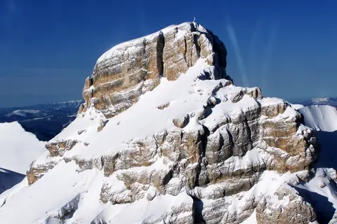
- La Tournette, 2,350 m, Bornes Massif · FranceBornes Massif · FranceAlpine hike2,350 m
From Les Prés Ronds via the Chalet de l'Aulp and the Col du Varo · T4 · 4h 30m up · best Sep · GPX
- Grand Veymont, 2,341 m, Vercors Massif · FranceVercors Massif · FranceMountain hike2,341 m
From Gresse-en-Vercors via the Pas de la Ville and the north crest · T3 · 4h 15m up · best Jun–Sep · GPX
- Le Roc d'Enfer, 2,244 m, Chablais Massif · FranceChablais Massif · FranceAlpine hike2,244 m
From Graydon via the Brèche de la Golette and the north summit · T4 · 3h 30m up · best Jul–Sep · GPX
- Arcalod, 2,217 m, Bauges Mountains · FranceBauges Mountains · FranceAlpine hike2,217 m
East face from Nant Fourchu via the Col d'Orgeval · T4 · 4h 45m up · best Jul–Sep · GPX
- Mount Aiguille, 2,087 m, Vercors Massif · FranceVercors Massif · FranceAlpine climb2,087 m
Voie Normale , descent by the Tubulaires couloir · PD+ · IV · 5h 45m up · best Jun · GPX
- Chamechaude, 2,082 m, Chartreuse Mountains · FranceChartreuse Mountains · FranceMountain hike2,082 m
From Col de Porte via the west slopes · T3 · 3h up · best Jun–Sep · GPX
- Dent de Cons, 2,063 m, Bauges Mountains · FranceBauges Mountains · FranceMountain hike2,063 m
From Le Raffort via the Creux du Cayon and Col de la Sellive · T3 · 3h 15m up · best Sep–Oct · GPX
- Mont Colombier, 2,045 m, Bauges Mountains · FranceBauges Mountains · FranceHike2,045 m
From Aillon-le-Vieux via the Combe du Cheval and Col du Colombier · T2 · 4h 15m up · best Sep–Oct · GPX
- Mont Lachat, 2,023 m, Bornes Massif · FranceBornes Massif · FranceHike2,023 m
From Forgeassoud-Dessus via the Chalet de la Mare · T2 · 4h up · best Sep–Oct · GPX
- Pic d'Orhy, 2,017 m, Orhi mountain range · France, SpainOrhi mountain range · France, SpainHike2,017 m
From the Port de Larrau · T2 · 1h 45m up · best Jun–Oct · GPX
- Peak of Céüse, 2,016 m, massif Céüse-Aujour · Francemassif Céüse-Aujour · FranceHike2,016 m
From the former Céüze 2000 ski station via the Sommet des Marseillais · T2 · 2h 15m up · best Sep–Oct · GPX
- Mont Ventoux, 1,910 m, Vaucluse Mountains · FranceVaucluse Mountains · FranceHike1,910 m
North side from Mont Serein by the GR4 · T2 · 2h 15m up · best May–Jun · GPX
- Puy de Sancy, 1,885 m, Monts Dore · FranceMonts Dore · FranceEasy walk1,885 m
From the Mont-Dore cable car station via the Col de la Cabane, descent by the Val de Courre · T2 · 2h 15m up · best Jun–Sep · GPX
- Le Môle, 1,863 m, Chablais Massif · FranceChablais Massif · FranceHike1,863 m
Normal route from Chez Béroud via the Petit Môle · T2 · 2h 45m up · best May–Jun · GPX
- Plomb du Cantal, 1,855 m, Cantal mountains · FranceCantal mountains · FranceEasy walk1,855 m
From the Col de Prat de Bouc via the Col de la Tombe du Père · T2 · 2h up · best Jun–Sep · GPX
- Monte San Petrone, 1,766 m, Massif du Monte San Petrone · FranceMassif du Monte San Petrone · FranceMountain hike1,766 m
From the Col de Prato · T3 · 3h 30m up · best May–Jun · GPX
- Crêt de la Neige, 1,721 m, Jura Mountains · FranceJura Mountains · FranceHike1,721 m
From Le Tiocan via Narderans and the Reculet · T2 · 4h 15m up · best Jun–Oct · GPX
- Mont Aigoual, 1,567 m, Cévennes · FranceCévennes · FranceHike1,567 m
Sentier des 4000 marches from Valleraugue · T2 · 5h up · best Apr–May · GPX
- Monte Asto, 1,535 m, Serra di Tenda · FranceSerra di Tenda · FranceMountain hike1,535 m
From Lama via the Refuge de Prunicu · T3 · 4h 15m up · best Apr–May · GPX
- Puy de Dôme, 1,465 m, Chaîne des Puys · FranceChaîne des Puys · FranceHike1,465 m
Chemin des Muletiers from Col de Ceyssat · T2 · 1h 30m up · best May–Jun · GPX
- Grand Ballon, 1,424 m, Higher Vosges · FranceHigher Vosges · FranceEasy walk1,424 m
From the Col du Haag on the Route des Crêtes · T1 · 45m up · best Jun–Jul · GPX
- Pic de Bugarach, 1,230 m, Corbières · FranceCorbières · FranceMountain hike1,230 m
From Col du Linas · T3 · 2h 15m up · best Apr–May · GPX
- Larrun, 905 m, Larrun mountain range · France, SpainLarrun mountain range · France, SpainHike905 m
From the Col de Saint-Ignace via Les Trois Fontaines · T2 · 3h 15m up · best Apr–Jun · GPX


Questions
- What is the highest mountain in France?
- Mont Blanc (4,806 m), in the Mont Blanc massif. The way up is the normal route, the Goûter Route via the Bosses Ridge, graded PD-, about 9h 30m up over 2 days. The best months are Jul.
- What is the highest mountain you can hike in France?
- Mont Giusalet (3,313 m): the normal route from Bar Cenisio via Rifugio Avanzà, graded T3, about 7h 30m up, with no climbing and no glacier.
- When is the best time to climb mountains in France?
- For most peaks in France, July to September. Higher and glaciated peaks have a shorter season; each peak page rates every month.
- How many 4000 m peaks are there in France?
- peaks.fyi covers 25 peaks over 4,000 m in France, led by Mont Blanc (4,806 m).