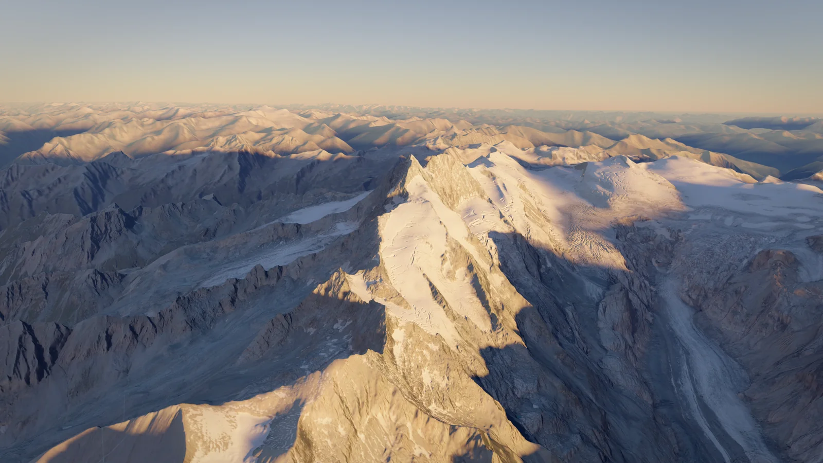
Grossglockner
3,798 m
Austria
Also known as Гросглокнер, Großglockner, +3Also known as
Гросглокнер · Großglockner · Γκροσγκλόκνερ · გროსგლოკნერი · Veliki Klek
- Elevation
- 3,798 m
- Prominence
- 2,428 m
- Difficulty
- 5/10
- Easy alpine
- Best Season
- Jul–Aug
- Routes
- 2
Hut closedReported 19 Sep 2026 · until 15 Jun 2027
The Erzherzog-Johann-Hütte is closed until mid-June 2027; no overnight stays are possible. Reservations for 2027 by email.
erzherzog-johann-huette.atWorksReported 3 Oct 2026
The east façade of the Erzherzog-Johann-Hütte was renovated in summer 2026 (new insulation, larch shingles and windows); the work is reported as complete.
erzherzog-johann-huette.at
Routes
2Sources differ: PD+ (bergsteigen.com) · Glocknerleitl up to 40° ice; rock I with short II (Erzherzog-Johann-Hütte) (erzherzog-johann-huette.at)
Austria's standard route to its highest summit: from the Lucknerhaus above Kals to the Stüdlhütte, across the Ködnitzkees glacier and up the cabled Mürztaler Steig to the Erzherzog-Johann-Hütte (3,454 m), then the 40° Glocknerleitl and a narrow ridge with iron stakes over the Kleinglockner to the summit. About 1,900 m of ascent, usually over two days.
Elevation Profile
approximate line- Distance
- 8.9 km
- one way
- Ascent
- +1,960 m
- −78 m lost on the way up
- High Point
- 3,798 m
- Time Up
- 7h 48m
- DIN 33466
- Time Down
- 5h 17m
- DIN 33466 · same way back
From the Lucknerhaus car park (about 1,920 m, toll road from Kals) a broad path climbs past the Lucknerhütte (2,241 m) to the Stüdlhütte (2,802 m), about 2½–3 hours. From the hut, head towards the Salmhütte for about 500 m, round the rock spur called the Schere and step onto the Ködnitzkees. Climb the left side of the glacier, then traverse right at the height of the Luisenscharte to the rocks of the Kampl. Cross the bergschrund and follow the Mürztaler Steig, a cabled path with a section of via ferrata grade C, to the Adlersruhe and the Erzherzog-Johann-Hütte (3,454 m), Austria's highest hut; about 2½ hours from the Stüdlhütte. The glacier has thinned a lot: the flank below the Adlersruhe is steeper and looser than it was, and local guides have built protected alternatives via the Blaue Scharte and the Burgwartscharte for days with high rockfall risk. From the hut, follow the broad crest ('Bahnhof') and then zigzag up the steep Glocknerleitl (snow or ice up to about 40°, increasingly bare) to the Sattele. Climb the slabby ridge (up to II-) to the Kleinglockner (3,770 m), descend steeply into the Obere Glocknerscharte, cross the narrow notch with a fixed cable and climb about 30 m of grade II to the summit cross. Iron stakes and ring bolts along the ridge allow running belays. Allow 1½–2 hours from the hut. Descend the same way; the Glocknerleitl and the notch are often abseiled. On fine summer days several hundred people are on the route and queues at the Glocknerscharte are normal. Most parties sleep at the Stüdlhütte or the Erzherzog-Johann-Hütte; sleeping at the higher hut gets you onto the summit ridge before the crowds.
Start
Lucknerhaus1,917 m
- Train to Lienz, then bus to Kals am Großglockner and on to the Lucknerhaus (summer service).
- Parking at the trailhead
Stages
| Day | Stage | km | m ascent | m descent | Time |
|---|---|---|---|---|---|
| 1 | Lucknerhaus → Erzherzog-Johann-Hütte | 7.9 | 1,613 | 78 | 6h 31m |
| 2 | Erzherzog-Johann-Hütte → Grossglockner | 1.0 | 347 | 0 | 1h 17m |
Waypoints
- Parking: Lucknerhaus1,917 m
- Hut: Lucknerhütte2,242 m
- Hut: Stüdlhütte2,803 m
- Hut: Erzherzog-Johann-Hütte3,452 m
- Shoulder: Kleinglockner3,769 m
not on route line
- Crux: Obere Glocknerscharte3,757 m
Narrow notch with fixed cable between Kleinglockner and Grossglockner (not on route line)
- Summit: Grossglockner3,798 m
Key Passages
- Ködnitzkees glacier and bergschrund at the Kampl
- Mürztaler Steig to the Adlersruhe (via ferrata C)
- Glocknerleitl (up to 40°)
- Kleinglockner ridge (II-)
- Obere Glocknerscharte and final 30 m of II to the summit
Equipment
0/10 packedDownloads
Route confidence 80%Overview
Austria's highest mountain (3,798 m), a steep twin-pointed rock pyramid in the Hohe Tauern National Park. The normal route from Kals crosses a small glacier to Austria's highest hut, then a 40° slope and a narrow, stake-protected ridge over the Kleinglockner; crowded, short in its difficulties, but a real alpine climb.
The Grossglockner rises on the main Alpine divide on the border between East Tyrol and Carinthia, the highest point of the Alps east of the Brenner Pass. Its summit is actually two pinnacles, the Grossglockner and the Kleinglockner (3,770 m), separated by the narrow Obere Glocknerscharte. On its eastern side the Pasterze, Austria's largest glacier, flows down towards the Franz-Josefs-Höhe at the end of the Grossglockner High Alpine Road; the Tyrolean side drops to the Ködnitz valley above Kals.
Most climbers come from Kals: a hut walk to the Stüdlhütte, a short glacier crossing and a cabled path to the Erzherzog-Johann-Hütte on the Adlersruhe (3,454 m), and then 1½–2 hours of snow, ice and grade I–II rock to the summit cross. The difficulties are short but exposed, and the summit block is a bottleneck: there are up to about 9,000 ascents a year and up to several hundred people on a fine summer day. Der Standard counted 29 deaths on the mountain since 2005.
Glacier retreat has changed the mountain. The Ködnitzkees is grey and rubble-covered, the flank below the Adlersruhe is steeper and looser, and the Glocknerleitl is increasingly bare ice or rock late in summer. Local guides now take only two clients per rope in normal conditions and have built protected variants for days with high rockfall risk. The Stüdlgrat, a well-equipped rock ridge, is the main alternative and the most popular route after the normal route.
Climbing Notes
You need basic glacier skills (roped travel, crevasse rescue), confident cramponing on 40° snow and ice, and the ability to climb and down-climb grade II in crampons in exposed terrain, plus fitness for about 1,900 m of ascent over two days. Acclimatisation is rarely a problem if you sleep at the Stüdlhütte or the Erzherzog-Johann-Hütte. Local guides from Kals and Heiligenblut guide the route daily in summer; with limited alpine experience the Erzherzog-Johann-Hütte itself recommends a guide.
Typical itinerary: day 1, Lucknerhaus to the Stüdlhütte (about 3 hours) or on to the Erzherzog-Johann-Hütte (about 5 hours); day 2, summit early and descend to the Lucknerhaus. Sleeping at the Adlersruhe lets you reach the ridge before the crowds coming up from the Stüdlhütte. Both huts require reservations in summer; the Erzherzog-Johann-Hütte takes bookings by email only.
Start early: the flank below the Adlersruhe is prone to stonefall in warm weather, afternoon storms are common, and descending the Glocknerleitl and the Glocknerscharte in a queue takes time. In bad visibility, navigation on the broad crest above the hut ('Bahnhof') is tricky.
History
Prompted by the first ascent of Mont Blanc, the Prince-Bishop of Gurk, Count Franz Xaver of Salm-Reifferscheidt, organised large expeditions from Heiligenblut. In 1799 parties reached the Kleinglockner but not the main summit. On 28 July 1800 a 62-strong expedition set out again, and according to the expedition records four local guides and carpenters (usually identified as the brothers Sepp and Martin Klotz and two others) and the parish priest of Rangersdorf, Mathias Hautzendorfer, crossed the Obere Glocknerscharte to the summit. The Erzherzog-Johann-Hütte belongs to the Österreichischer Alpenklub (founded in Vienna in 1878), which also owns 114 m² of the summit area and the summit cross. In January 2025 a woman died of exposure close to the summit after a winter attempt with her partner; her partner was later put on trial over her death.
Season
Best Jul–Aug- January: Not advisable
- February: Not advisable
- March: Possible
- April: Possible
- May: Possible
- June: Good
- July: Best (best window)
- August: Best (best window)
- September: Good
- October: Possible
- November: Not advisable
- December: Not advisable
- Jan
- Winter ascents only for experienced parties; huts closed (Stüdlhütte emergency room only)
- Feb
- Winter conditions
- Mar
- Ski-mountaineering season to the Adlersruhe; Stüdlhütte opens for ski tourers in spring
- Apr
- Ski-mountaineering; summit ridge often icy
- May
- Spring ski ascents; snowy ridge
- Jun
- Erzherzog-Johann-Hütte opens mid-June; good snow on the Glocknerleitl
- Jul
- Main season; very crowded on fine days
- Aug
- Main season; more rockfall and bare ice in heat waves
- Sep
- Quieter; Glocknerleitl may be bare ice; Erzherzog-Johann-Hütte closes in September
- Oct
- Stüdlhütte last night 3/4 October in 2026; early snow
- Nov
- Winter conditions
- Dec
- Winter conditions
Access & Permits
- Hut Booking
- Stüdlhütte (DAV München & Oberland): online via hut-reservation.org or by phone in season. Erzherzog-Johann-Hütte (ÖAK): reservations by email only (info@erzherzog-johann-huette.at); bookings for 2027 are open.
- Fees
- Toll road from Kals to the Lucknerhaus car park
- Erzherzog-Johann-Hütte 2026: dormitory with breakfast EUR 44.50 (alpine club members) / EUR 56.50 (non-members); half board EUR 83 / EUR 95
- Stüdlhütte overnight fees with alpine club discounts
- Rules
- Hohe Tauern National Park: national park rules apply (stay on paths, no wild camping)
- Erzherzog-Johann-Hütte: overnight stays only with a reservation
- Stüdlhütte has no winter room; outside the season only an emergency shelter is open
- Getting There
Kals am Großglockner (Tyrol); Heiligenblut (Carinthia) for the eastern approaches
Innsbruck (INN) or Salzburg (SZG); Klagenfurt (KLU) is also within reach
- Train to Lienz, then bus to Kals am Großglockner and, in summer, on to the Lucknerhaus
- Car: B108 from Lienz or through the Felbertauern tunnel to Huben, then up the Kals valley to Kals and the toll road to the Lucknerhaus
- From Carinthia: Grossglockner High Alpine Road to the Glocknerhaus or Franz-Josefs-Höhe for the Salmhütte and Hofmannsweg approaches
Hazards
- Glacier
- Crevasses
- Rockfall
- Exposure
- Weather
- Altitude
Huts & Shelters
3- 2,241 m
LucknerhütteHut
- 2,802 m
StüdlhütteHutStaffedBooking required
122 beds · Spring ski-touring season and summer; last night 3/4 October in 2026; no winter room, emergency shelter only
- 3,454 m
Erzherzog-Johann-HütteHutStaffedBooking required
100 beds · Mid-June to September